Adventure: Wye not forage for dinner?

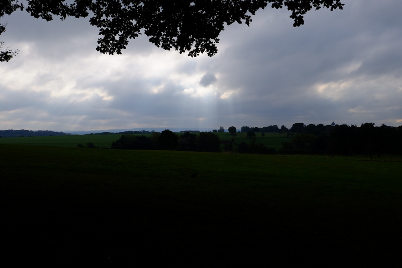
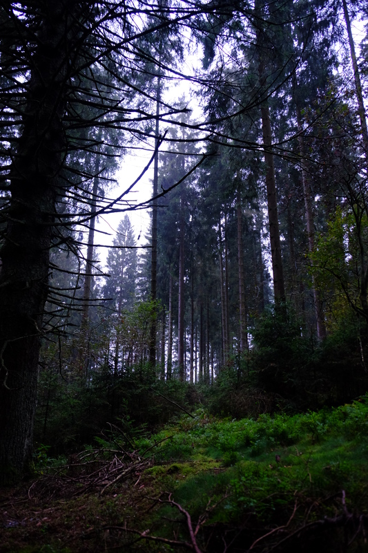
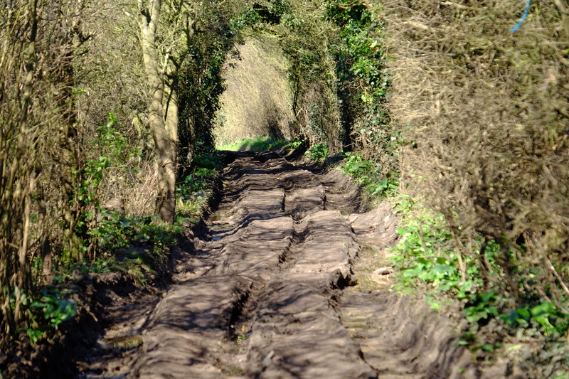
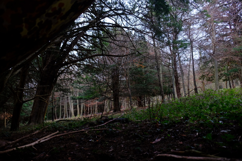
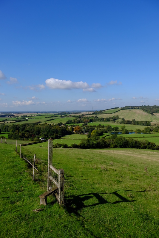
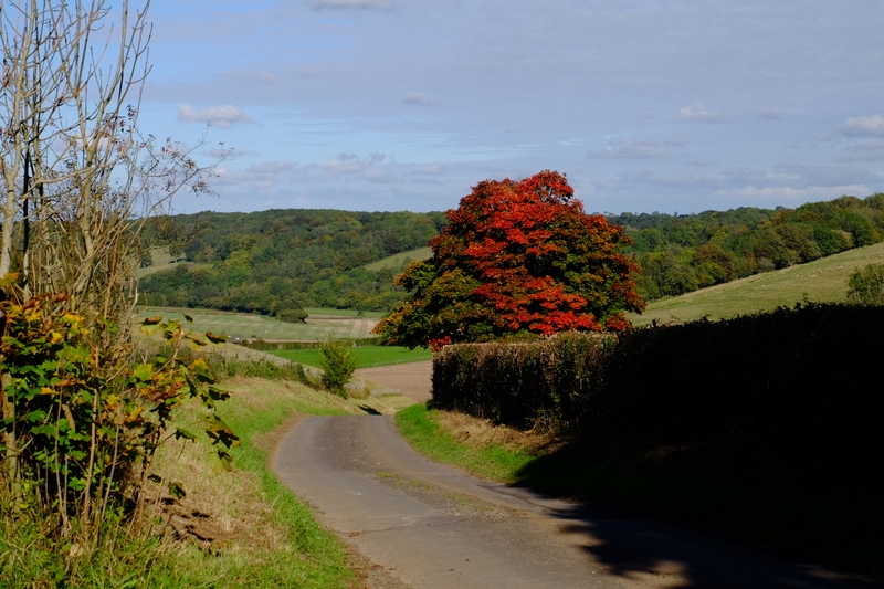
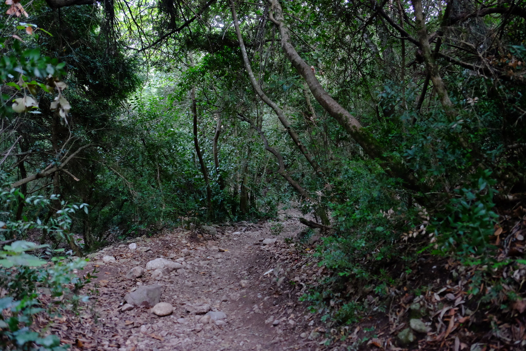
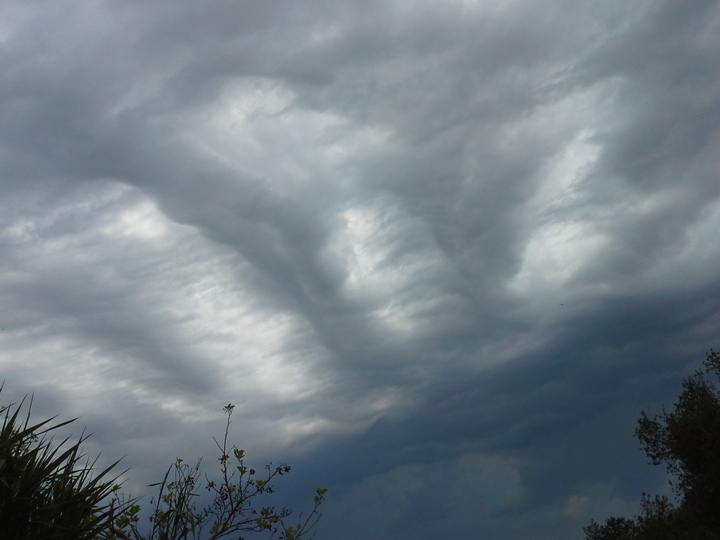
As I stood where the path should be looking up at the stinging nettles above me, I started to question my navigational choices. We were on this path because the path we wanted to take was hidden under an impassible jungle of Brambles, nettles and other spiky vegetation. Batting Triffid like nettles out the way with my poles as I walked, I wasn’t sure this path was any better.

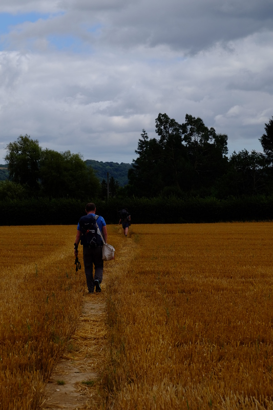
The path I was on is somewhere in east Kent, and unusually for my trips, I’d managed to persuade 3 others to join me for this hike. Ahead disappearing into the undergrowth were Jesper, Jim and Jules. But this was a hike with extra purpose, this time, we hiked for science.

A Hypothesis.

Every year someone (usually a young bloke in their late teens) asks on one of the Bushcraft forums that we all use a question along the lines of:

My mates and I want to do a hike, foraging and living off the land as we go, can anyone give us suggestions on where to go and what to forage for?

And every year the regulars on the forum give patient well worded replies along the lines of:

You can hike, or you can forage, but not both

It’s a simple enough equation. The adult human needs 2000-2500 kcalories a day to cover their needs, more if they are expending any great effort. Whilst the modern human has access to refined sugar, copious mass produced carbs and endless fats, in nature it’s not so easy. If you grab a book on wild food, you’ll find a whole catalogue of things you can eat without killing you, but to cover your 2000 calories, how many of these would you need? Unfortunately the standard indexes of calories in foods don’t tend to include things like Goosegrass, Bog Myrtle, or Nettles. But looking at the crop wild relatives of some foods that calorie numbers are available for, you can get a rough idea. Assuming that cabbage and sea kale leaves aren’t too dissimilar, how much would you need to eat in a day to cover your 2000kcal? Roll some dice, crunch some numbers, and you get a figure around 6kg. Yes, SIX kilograms of sea kale. I’ll buy a pint for anyone who can prove they’ve eaten that in a single day… Not exactly ideal. What about apples? An apple is about 50 kcalories. So you’re looking at 80 apples. So the numbers are pretty damning. You’re not going to be able to forage for enough food to meet your energy requirements let alone hike any distance at the same time. But this is just a theory, it’s just numbers. What we really needed to do, was put this to the test.

Method

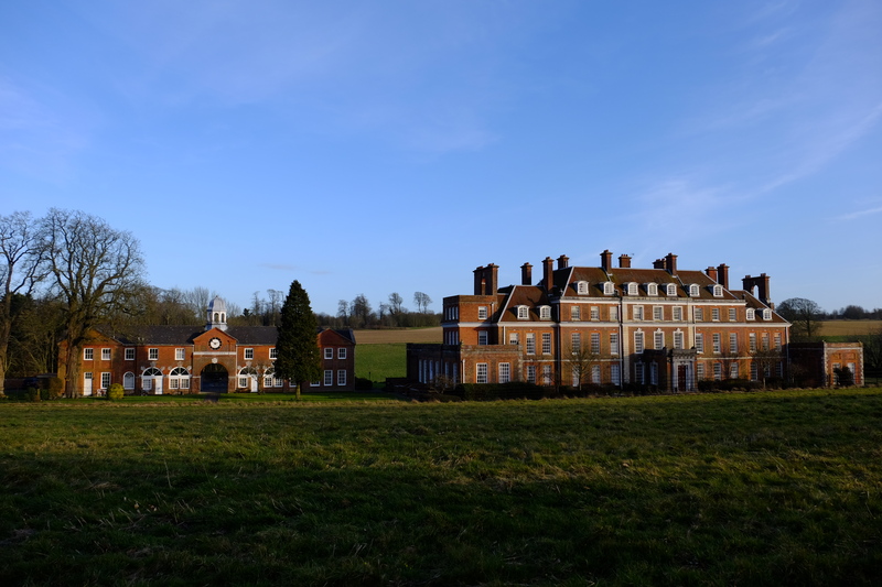
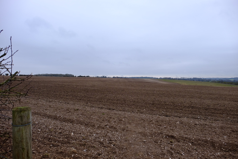
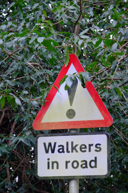
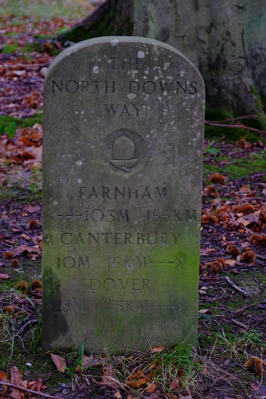
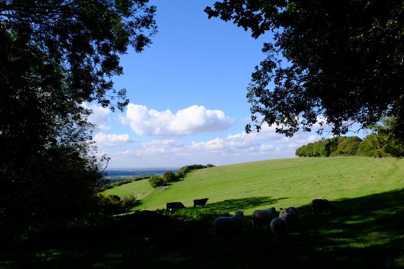
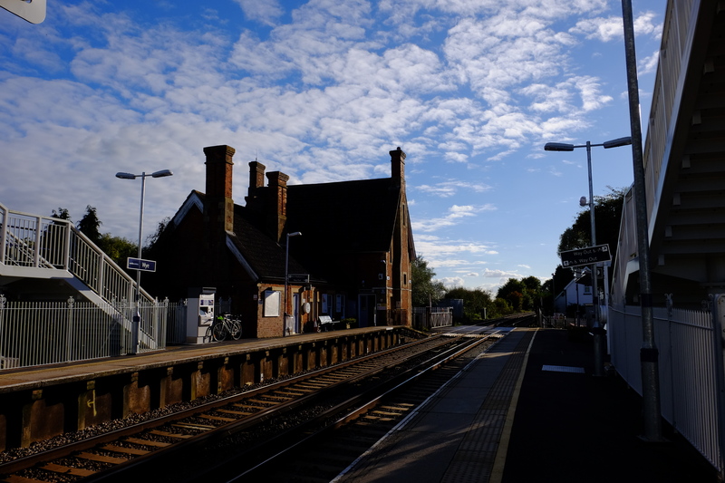
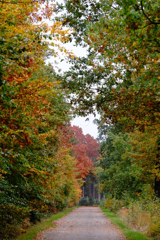
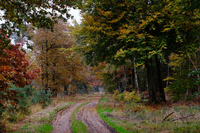
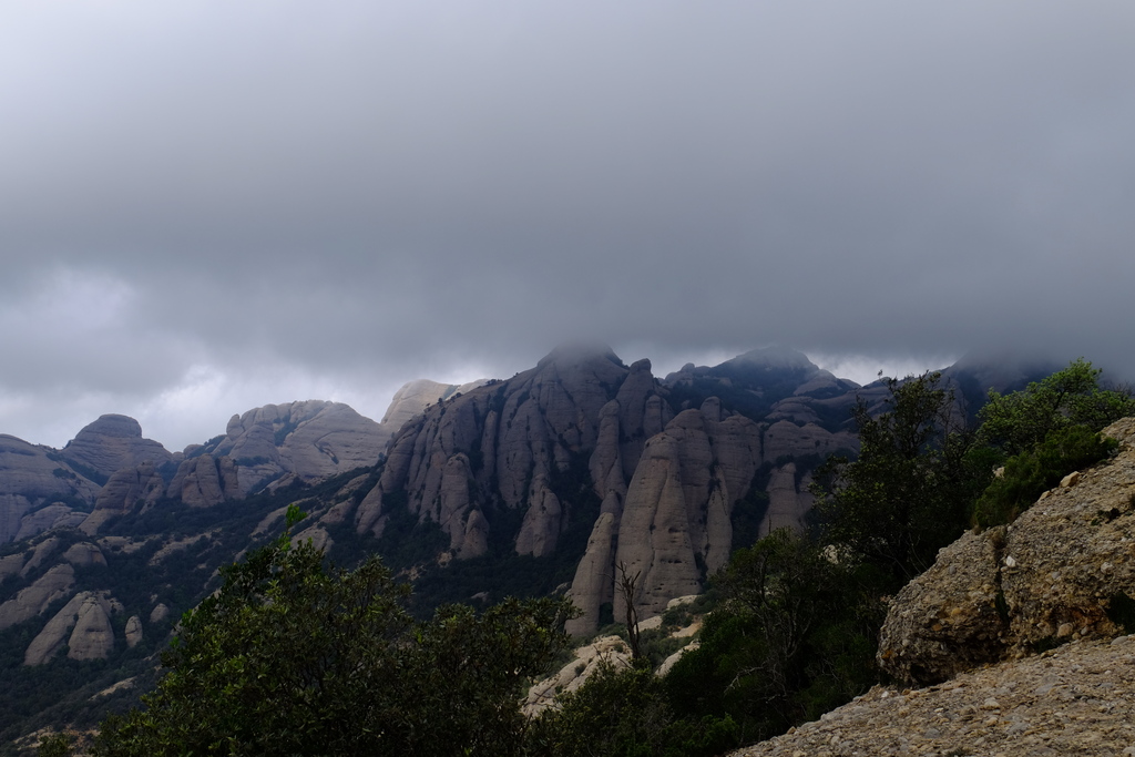
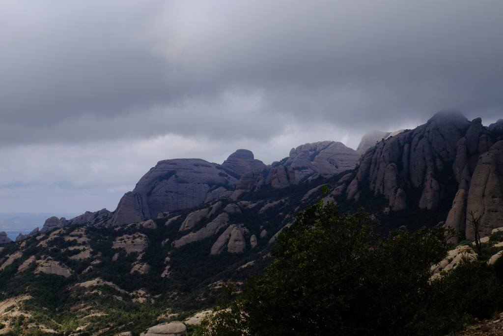
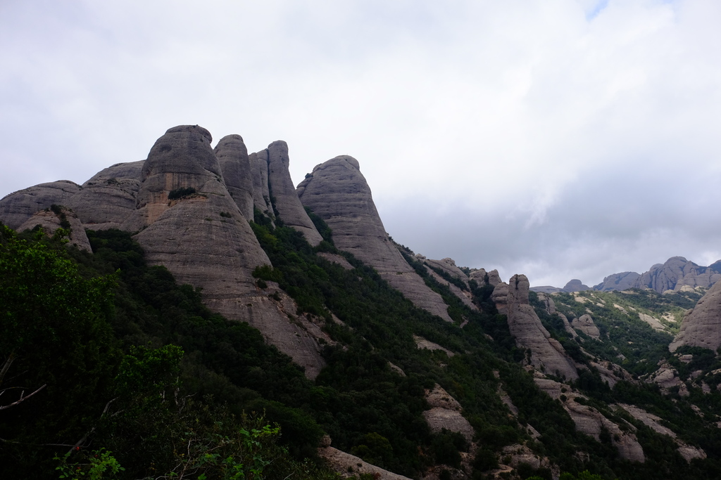
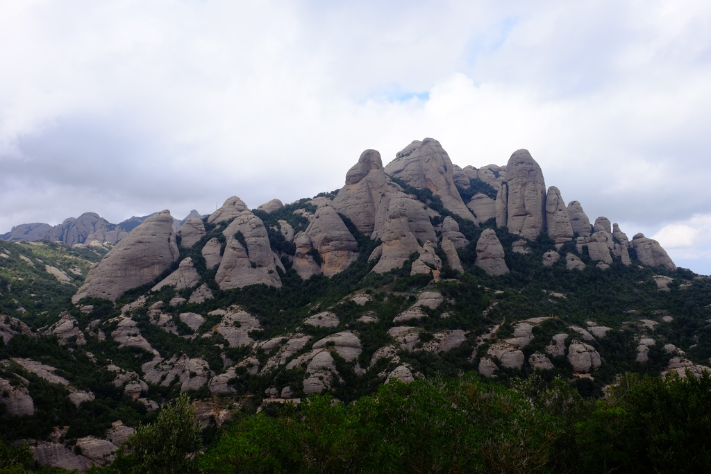
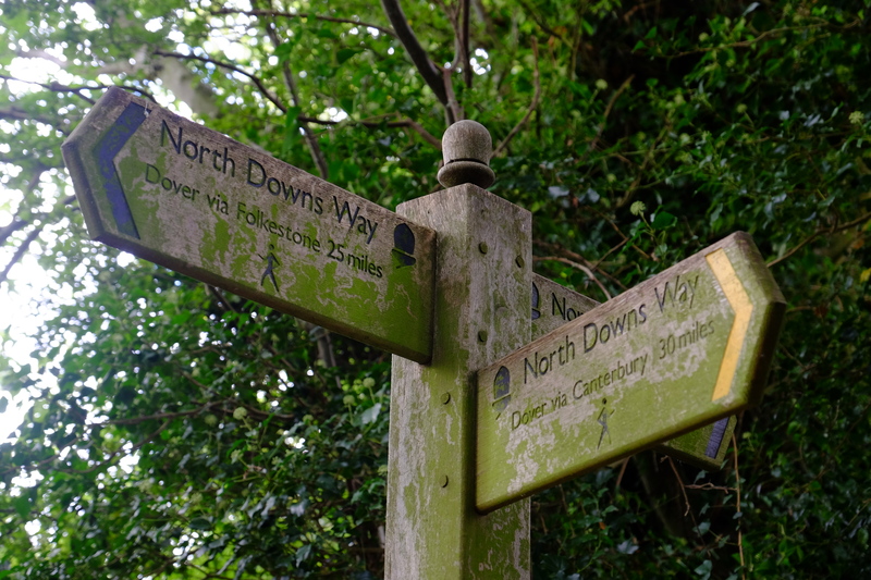
Our basic plan was 4 people with varying levels of knowledge of wild food, and varying fitness would meet up somewhere in Kent, and do a 2 day hike with an overnight bivvi, trying to forage for our dinner as we went. So as to not try to bite off more than we could chew, the route we settled on was a simple 25km loop starting and finishing at Wye station. This would take in varying habitats including woodland, hedgerows, field margins, access land, and a section of the North Downs Way. Giving a good representation for a hike in Southern Britain.

UK law would limit our foraging to the four F’s – Fungi, Foliage, Fruit and Flowers. This gives us a vegetarian diet, but in theory should give us access to all sorts of interesting food stuffs. Assuming we could find them, identify them with certainty, and in some cases reach them.

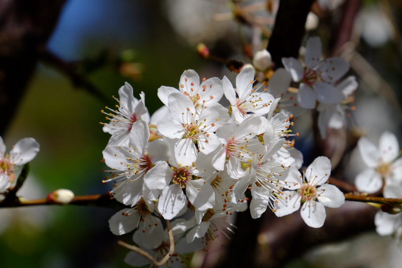
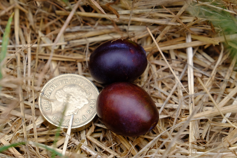
We left the station in good spirits. Jules, Jesper and myself. Jim would join us a bit later. We decided we’d let ourselves get out of the village before we started to forage, other wise we could easily end up getting nowhere. We made it 100 yards up the North Downs Way towards the Wye Crown before coming across a really good patch of black berries that were too good to miss. We foraged for 5 mins, trying to find as many as we could in that time – a few handfuls. We could have spent an hour there and picked the area clean. But if we did that, our average speed would make the whole trip untenable. But it was a start, we had something, even if it wasn’t much. A bit further a long I spotted a squashed plumb on the floor. I’ve long realised that often the easiest way to find fruit trees is to look on the ground for their windfalls. We now knew there was a plum somewhere near by, we just had to find it. A search of the nearby hedgerow located the tree, as well as it’s crop of a plum. One solitary plum, about 8 feet off the ground. Just out of reach. Bah. Ah well. Onwards.

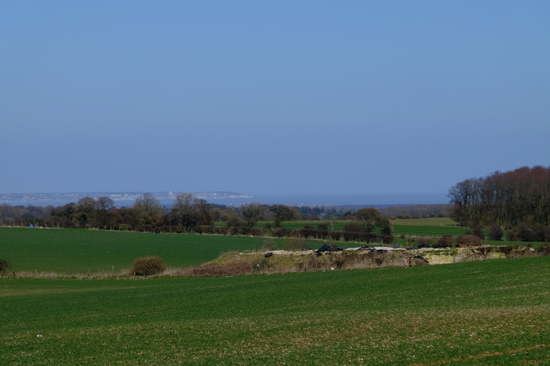
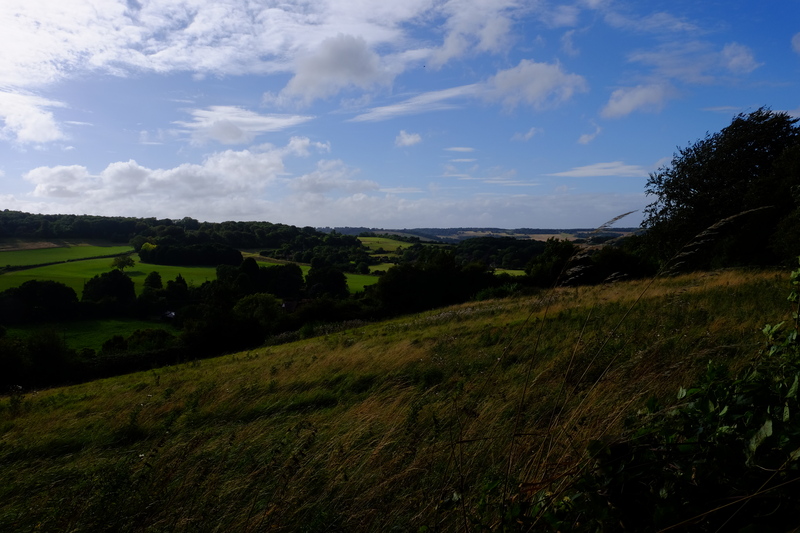
We progressed up the hill to the Wye crown were we stopped to drink in the view, and drink some of our water. It was blowing quite a hooley up there. As we crossed the ridge we wandered along the edge of a recently harvested wheat field. In various places unharvested seed heads lay on the ground and in a few places stalks that the combine had missed stood dancing in the wind. We grabbed a few handfuls, it wouldn’t be enough to bake a loaf, but it would be a welcome addition to what ever stew we could come up with for dinner.

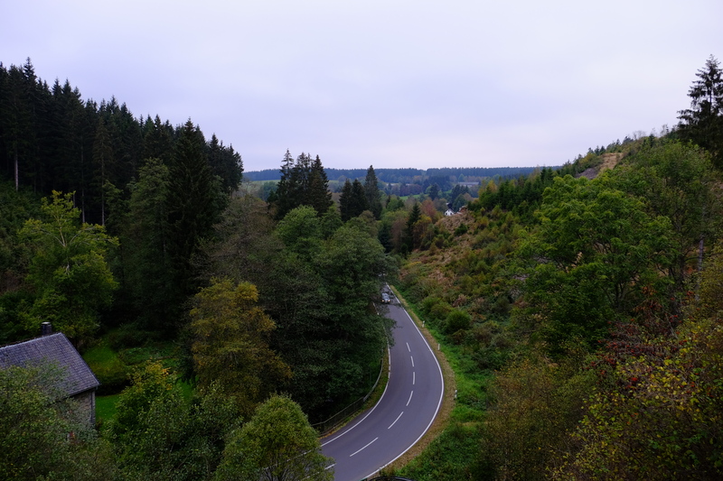
With the strong wind we were grateful to drop down the other side of the ridge into a valley, where we passed along well maintained (read threshed to bits) beech hedging. A linear monoculture. Beech leaves are technically edible, I used to infuriate my Arboriculture lecturer in ID classes by eating the samples to tell the difference between beech, hornbeam, elm and birch leaves (apparently this isn’t the approved method…), but this late in the season (late August) they don’t taste very good, nowhere near as tasty as first thing in the spring. There may have been a few edible weeds around the base of the hedge, but there were prime dog pee height and none of us wanted to spend much time checking them.

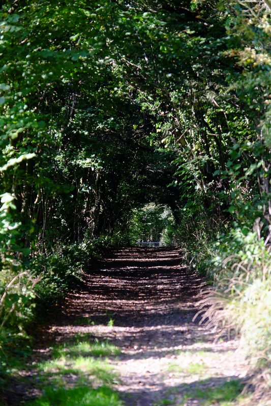
Continuing on we entered woodland. I stopped to look at the map, checking were were going the right way when I heard.

“Is that a chicken?”

“Where?”

“There.” I looked up from the map to see where Jules was pointing. Yep, that was chicken of the woods(Laetiporus sulphureus). Five metres up in the crotch of a mature oak was a large chicken of the woods mushroom. We stood staring, trying to work out if there was anyway we could reach it. None of us had brought any climbing equipment, nor ropes, and the 3m or so to the lowest branch didn’t seem like something we could safely reach. Tauntingly, we left it behind us and continued on. As we walked we found a fallen ash tree that provided some cramp balls (Daldinia concentrica), and fallen birch tree yielded copious quantities of bark. We could at least forage forage for our fire lighting materials if nothing else.

Lots of flowers, some of them are edible. But which?

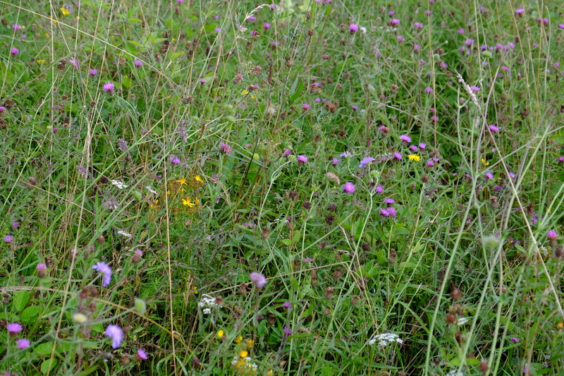
Exiting the woodland we found ourselves on a hillside that had been seeded with wild flowers as food for pheasants and other wild birds. We tried to identify various edibles among the grass, but none of us could be certain about a lot of them.

We decided that it was a good time to start thinking about coffee. Crundale church was a couple of kilometres away and the bench there would make a great place to have a break. I had a small wood gas stove in my pack that I picked up on ebay. In theory it would burn twigs very efficiently and save us the need to carry fuel. But this meant we now needed to add fire wood to our foraging. We walked, eyes everywhere trying to spot things that might be edible, as well as any dead standing twigs that would burn.

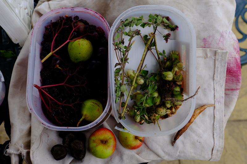
Arriving at Crundale church we set out our harvest so far. Blackberries, Hazel nuts, wheat, some leaves, a couple of cramp balls, birch bark and some twigs. Not exactly inspiring.

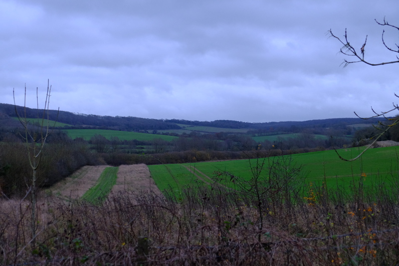
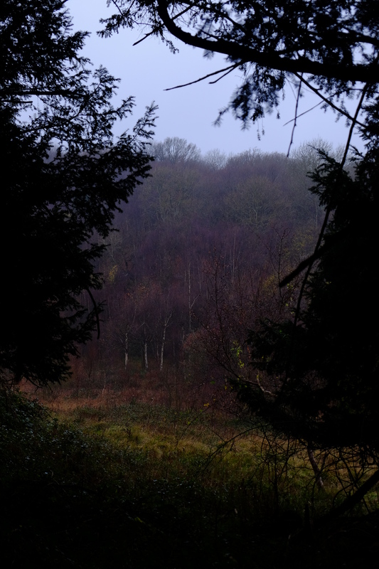
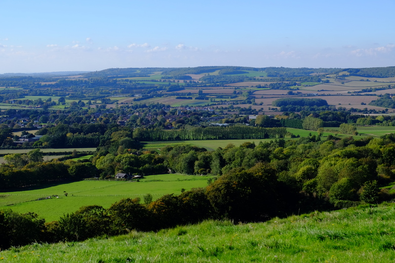
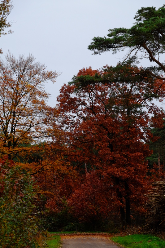
Located on top of a ridge just outside of the village of it gets it’s name from, Crundale Church affords a beautiful view that  more than made up for our poor harvest. As we admitted that our hypothesis was looking proven, we dug into the emergency backup Mars bar supply. The downside of being on the ridge was the wind. Trying to light the stove by the bench wasn’t going to be an option, so we sheltered behind a yew tree, adding out backpacks and bodies as extra protection. Thus followed an hour of trying to get the stove to boil a pot of water. The wind provided cooling to the pot, as well as made keeping the fire going really hard. Feed it too fast and it would choke and go out, Feed too slow, and it would starve. Eventually we decided that this was never going to boil and transferred the water to a gas stove and had coffee ready a couple of minutes later. With impeccable timing this was the point Jim turned up. Drinking the coffee we winnowed the wheat we’d found, here the wind was useful.

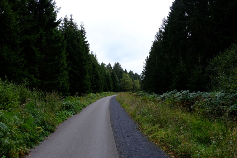
Fed and watered, we set off down the road. After our game of “how many bushcrafters does it take to boil the kettle.” We now began a game of “how many bushcrafters does it take to find the right path”. Eventually we found the path we wanted and headed towards Eggringe wood. We had some fun navigating the forest tracks and pathways, but as we were approaching the way out of the woods we hit pay dirt. Burdocks! (Arctium lappa). Using a potty trowel, and a hastily carved digging stick, Jim and Jules dug around the base of a large plant to extract the root. After much digging they proudly raised their treasure for all to behold. Six inches long and barely thicker than a thumb, we had a dock root. We had starch. We discussed the merits of our new bounty. Given the effort of digging it up, we concluded that it wasn’t exactly an efficient use of energy or time. Growing nearby we found some mint plants and raided a few sprigs that we could perhaps use to make mint tea with.

Continuing on towards Chilham Down Jules introduced us to the culinary hit of the trip. Nettle seeds. Available in large quantities, and tasty, they provided a food we could graze as we wandered, as long as you were ok to put up with the occasional sting.

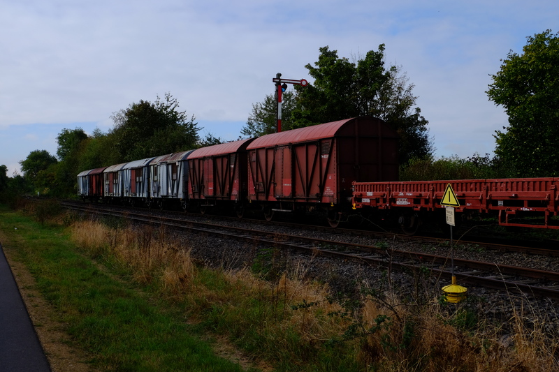
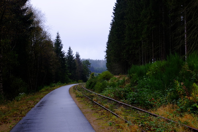
The path from Down wood to Chilham down proved to be interesting, with nettles and brambles towering over our heads. Several times I questioned which idiot had chosen this route (that would be me). Finding one route over grown we opted to detour down towards the cycle route at the bottom of the hill, this was hardly any better, but eventually it did end and we found ourselves on the cycle route next to a railway line and the A28.

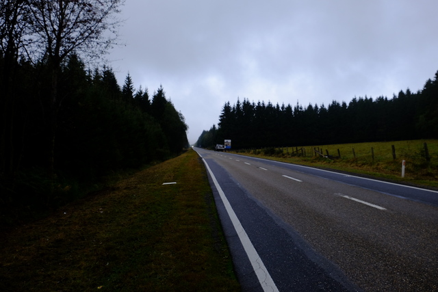
Map check revealed we were nearly a kilometre further south than intended. This did present us a new option tho. At the cost of a short section of road walk, we could cross the river and continue on the other side which should be prettier. We also concluded that having largely failed to find enough food to feed 4 people, it might be best if we diverted to Chilham to take on fuel at the pub.

It was a good theory, and having navigated the most optimistic kissing gate design I’ve ever seen (none of us fit through and had to climb over), we wandered along the edge of a field by the river. Alas the route marked on the map seemed to disappear into the under growth and provide no useful way forward. We ended up skirting all the way round the edge of the field before eventually finding a gap in the hedge that allowed us out onto Mountain Street half a km south of where we intended.

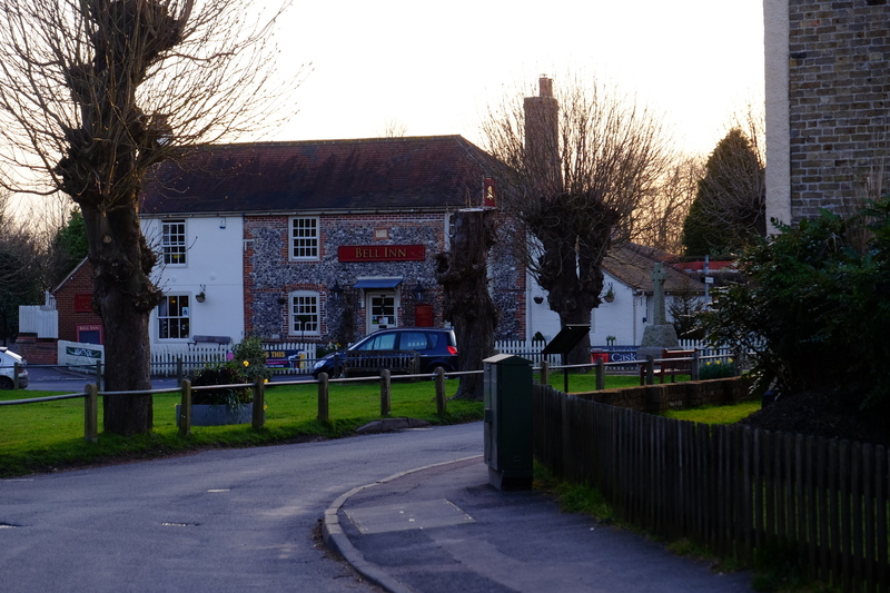
With the gravitational pull of a pub exerting it’s influence upon us, we picked up the speed along the road to the Woolpack inn for a well earned dinner.

After dinner Jesper had to head off, leaving Jim, Jules and myself to continue on in search of somewhere to sleep.

Our camp…(What is the collective noun for tarp shelters?)

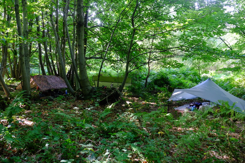
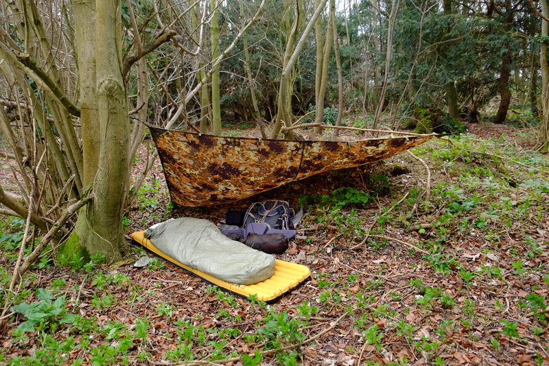
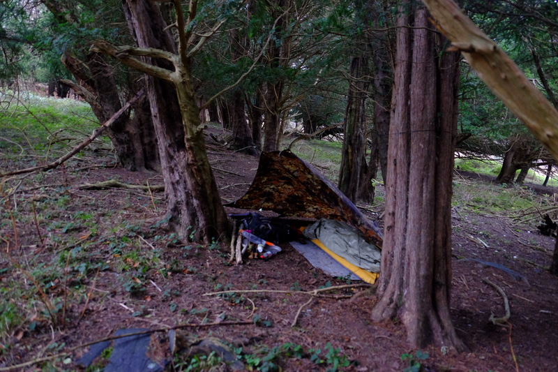
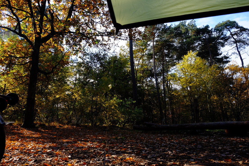
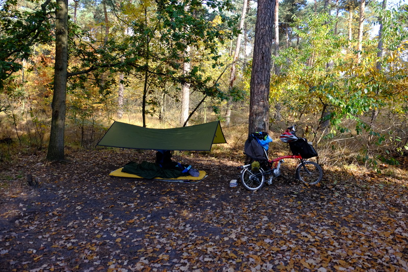
Exhausted and in the dark the three of us hunted out a suitable spot to sleep in nearby woods. Tarps up, bivvi bags deployed, we hit the hay for a well earned sleep.

Morning revealed that perhaps our choice of bivvi spot wasn’t as good as we had thought in the dark the previous night. Out attempt to get out of site of 2 paths had put us in rather obvious view of another. Fortunately noone seemed to have noticed us (or been bothered enough to react to us at least). We broke camp and back tracked to the North Downs Way which we would now follow all the way back to Wye.

In light of our poor foraging yield the day before we decided that we would be better off seeking out a pub lunch in Wye, leaving us more time to concentrate on the scenery and just walking.

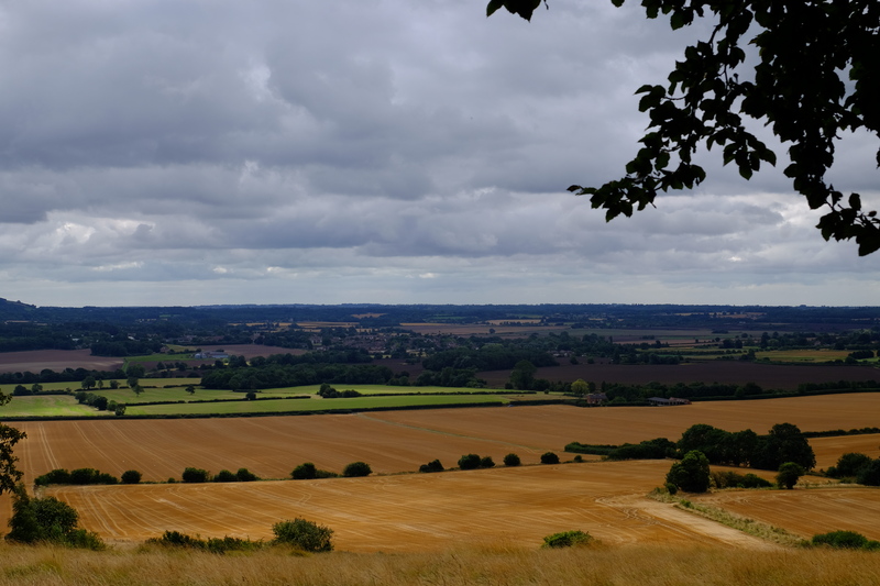
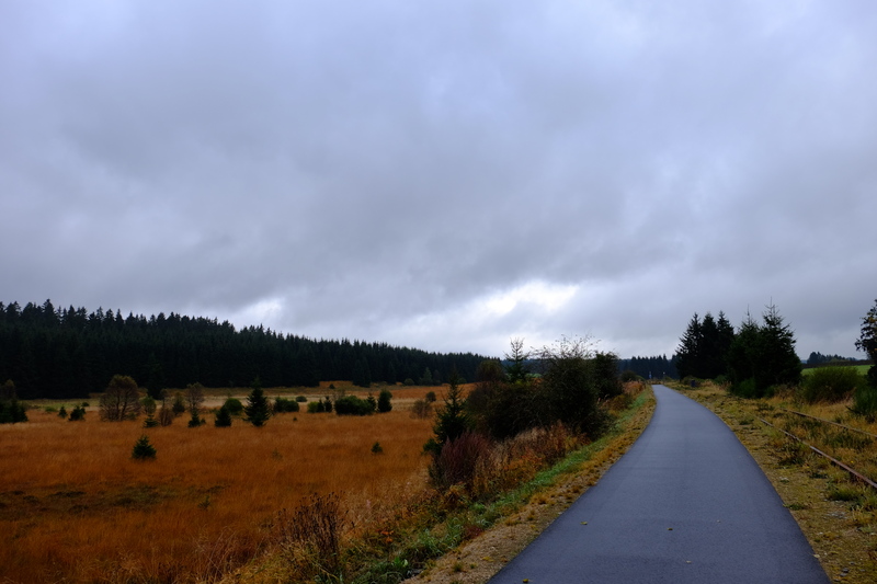
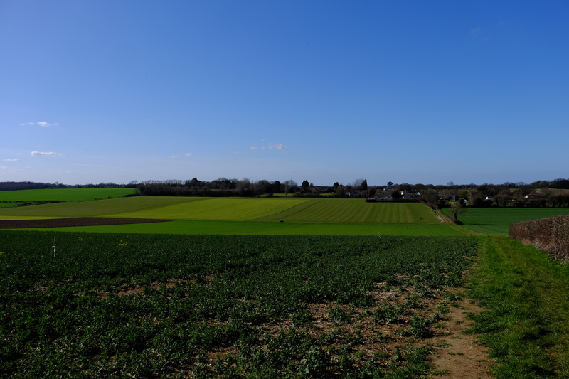
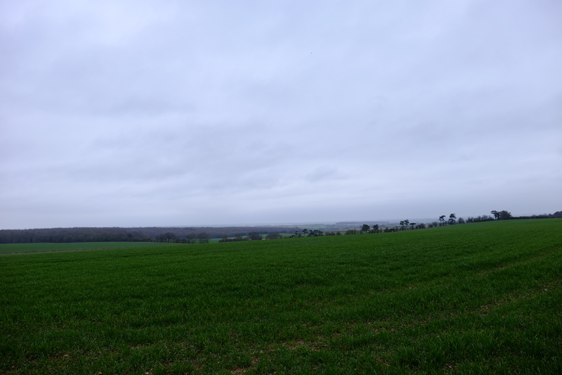
Leaving the Kings wood we descended into a landscape of golden fields in various states of harvest. Down hollow ways and field edges we arrived at Boughton Lees. This is where the North Downs Way splits on it’s route towards the sea, with one route going via Canterbury and one route via Wye.

In one of the hedge rows we found a tree from the Prunus family with plump fruit. We couldn’t work out if it was a large slow, or damson, or a bullace, or diminutive plum. Jules seemed to find them tasty enough tho.

Prunus of some kind…
A group of three? or a trio of solo hikers in loose formation?

Crossing the A28 we found ourselves at Perry Court Farm. Here we found the important trio of clean loos, tea, and cake. The idea of which was too much, and so 1km earlier than planned, we decided to stop for lunch here. Jim got a call from his other half who was in the area and wondered if we wanted a lift. With sore feet and having achieved what we set out to, we decided to accept the lift and end the hike here.

Results

So what of our experiment?

Despite being one of the more bountiful times of year, we hadn’t been able to find enough wild food to feed the 4 of us, and in trying we’d ended up hiking well beyond dark, pitching camp at gone 2300. We discussed the experiment over tea and concluded that had we gone to one location, set up camp, and then done forage parties round that area we probably could have foraged enough to make meals that didn’t leave us too hungry. Tho still short on energy requirements for the day. If we could add fish or fowl, then hitting it becomes more achievable. We also felt that you need a much greater knowledge of wild edibles than collectively we had. If we had carried a few staples like rice, flour, instant mash, and some stock cubes. Then we could easily have added foraged ingredients to liven up what could be otherwise bland fare.

Our harvest.

Conclusion

In conclusion, our hypothesis seems to be about right. You can walk or you can forage. You can’t reasonably expect to do both to any substantial degree. This shouldn’t preclude the inclusion of foraged ingredients in ones diet when travelling, but perhaps to supplement ones dehydrated meals. Maybe a dessert of blackberries, or a wild leaves salad starter. Rather than the core of your diet.

ADVENTURE: Bordering on Insanity – A Brompton Adventure

Belgium. Brunt of jokes on radio 4 comedy programs, Brewer of brilliant beer, and maker of fine chocolates. It’s often grouped in with The Netherlands and Luxembourg as the low countries. It’s easy to think of Belgium as a polder landscape punctuated with abbeys awash with beer. Tell someone you’re setting out to cycle to the highest point of the country, it doesn’t immediately come across as a particularly big challenge. Point out that the highest point is 694m above sea level, and you start to get some amusing reactions.

In summer 2015 I set out on my Brompton to cycle from Wiltz (Lu) to Aachen(De) via the highest point of all three of the low countries, Kneiff (559.8m), Signal de Botrange (694 m), and Vaalserberg (322.7 m). I made it to the top of Knieff, before aborting due to the heat. I wasn’t happy about aborting, tho I know in my heart that it was the right decision. As soon as I got home I started planning a second attempt. I’d done Knieff, so there was no point trying that bit again. I opened the map of the Hoge Venen, the area in which Signal de Botrange is found, and started to plan.

The borders of Belgium allow for some creative cartography. Exclave and counter exclave in the area of Baarle-Hertog provides an interesting diversion. But as I stared at the map, what caught my eye was a strange border marking through the middle of Germany. I switched from the paper map to opencyclemap. What was marked as a border on my paper map, showed up as a cycle path on OCM. I googled the cycle path.

Opened in 1885, the Vennbahn railway ran from Aachen to Trois-Ponts. In 1919 as part of the Treaty of Versailles, the line was given to Belgium. Creating in the process, exclaves of German territory within Belgium. With the closure of the railway, this line was turned into a cycle route. A cycle route that ran from Aachen to just south of Signal de Botrange, and did so with a maximum gradient of 2%. A plan formed. I could ride from Aachen along the vennrad to Sour Brot, where I could hang a right for the final ascent up to Botrange, then it’s just a simple down hill all the way to the Netherlands, via a bit of Germany and Belgium, and maybe the curiosity that is Moresnet.

And so on a somewhat grey but cool day in October I set of from a youth hostel next to Aachen Hauptbahnhof, and followed my GPS through the city streets of in search of a strip of Belgium.

The first few kilometres of the ride took me through rather unscenic suburbs of Aachen, before eventually I left the industry and houses behind and entered farmland.

The day had started quite chilly, and I had worn both my wind proof and fleece to begin with, but as I got into the groove, I shed the windproof. My body was warm, but my summer shoes with their ample ventilation were making my toes cold.

I pressed onwards and upwards.

I had been led to believe from my research that the railway line had been removed along all of it’s length apart from a short part now used for rail biking. So I was a bit surprised when track started to appear next to the path. I was even more surprised when the cycle route deviated slightly from the railway and when I rejoined it a number of wagons and a loco were parked on the rails.

I pedalled on towards Belgium proper. I knew from my map that the route crossed into Belgium near Botz, before doing a large loop back on itself to exit Belgium, yet remain Belgium surrounded by Germany. Before the turn a disused triebwagen lay in a siding disconnected from the railway, covered in graffiti.

As I pedalled on my feet got colder. By the time I rounded the turn and headed back west towards Belgium-Surrounded-by-Germany, my toes were starting to feel numb.

When I packed for this trip 2 weeks previous (I had tacked it onto the return of a week in Eastern Germany), the forecast had been for relatively warm weather, with night temps of 9°C, and day temps of nearly 20°C. Just days before I was due to start riding the weather had swung towards cold. As my toes got colder, I started to worry that I had the wrong sleeping bag. I’d packed my summer bag hoping for temps in the 7-10°C mark. Much colder than that and night time could be rather miserable.

The kilometres ticked by. As I approached Roetgen my feet had gone from comfortably numb, to painfully so, everything forward of the metatarsels was in numb pain. Reflecting that it was somewhat ironic that on a trip that gave me issues due to excess heat the first time, would cause me issues with cold on the second attempt. I considered my options and decided that I would hang a left into Roetgen in hope of finding a cafe or coffee shop where I could warm up, and as it was around midday, maybe find some lunch.

A speedy descent into Roetgen following the signs for zentrum brought me to a main road, where I saw a bakery and cafe. I screeched to a halt and carefully wheeled my bike in, resting it just behind the door. The staff at the counter looked up, but didn’t say anything about the bike in the building.

“Sprechen sie Englisch?”

“Nein”

Ok, this should be fun, time to see if the previous 260 days of Duo lingo had been of any use.

With much pointing, poor German, smiling, and a lot of hope, I managed to order a hot pizza and a bottle of coke. I plonked down in a comfortable chair, ate my lunch and with each heart beat felt the feeling slowly return to my poor feet. I spent nearly 90 minutes warming up and sampling the German cakes. The time to leave approached, I considered the options for my feet. I didn’t have any over shoes to keep the wind off, nor did I have any plastic bags that might work. I did have a thick pair of wool socks. Would adding those to the socks I already wore provide enough warmth, keep the wind out enough, and above all, fit inside my shoes? I tried the left (and bigger) foot first. It fit. Snug, but it fit. I put the other sock on, and prepared to go out again.

The descent into Roetgen had been fast and fun. But this meant that to get back to the Vennrad would mean going up. Fortunately not too much, and I ground my way up in bottom gear. The relative flatness once I rejoined the route of the railway was most welcome. The double sock solution seemed to be working, not too warm, nor too cold, pretty much just right. Temperature sorted, I started to pay more attention to my surroundings.

Coniferous forest flanked me on either side for several kilometres. Here and there I could see beyond the bracken into the understory, passing dozens of spots that would make great wild camp locations. This filled me with hope for later when I would need to find somewhere to bivvi down. The rough plan in my head being find somewhere just before Kalterherberg, before the route left Germany behind.

Along the route were regular signs with a map of the Vennrad, a blurb about the history of the route, a useful “you are here”, and an even more useful elevation graph.

The elevation graph told me that at Lammersdorf things levelled out a bit and may even descend. This would be most welcome, tho every metre of descent would have to later be paid for with more ascent. But for now I welcomed the ability to coast for a bit.

At Lammersdorf I also found a sign telling me about the locals.

There's Beavers in them thar hills!

There’s Beavers in them thar hills!

In the lead up to this trip I had joked with friends that if I had an accident on this trip I could have the accident in Belgium, land in Germany, and it would be a nightmare on the insurance form. This had also got me thinking about how one might call in such an event. How would they know where I am? As it turns out, every 500m along the route signs gave details of who to call, and where you were. A bit like hecto-metre posts on motorways.

I cycled onwards towards my intended overnight camp. The kilometres went by, the terrain changed subtly. Forest  became higher, and the gradients either side became steeper.

Just beyond the turning for Monschau something in the distance caught my eye. I pulled out my camera and looked through the zoom lens. Yep, it was. Far off in the distance, near the edge of the field, a deer grazed.

I spent a few minutes just watching the deer. I was far enough away that it either couldn’t see me, or didn’t consider me a threat. It was the only mammalian wildlife I’d see other than a couple of red squirrels near Aachen.

A few kilometres further on I passed 50km distance for the day, and started to think about where to stop for the night. Around this point the terrain either side of the track tool a turn for the unhelpful. Large rocky outcrops towered on my right, whilst a steep ravine fell away to my left. This would certainly make finding a spot to camp harder.

I crossed a viaduct over a valley, hoping that the woods I could see on the other side would yield a potential camp spot. No such luck, ravines and boulders. Even if there was a flat spot big enough for my bivvi bag there, I wouldn’t get to it with the bike.

A few hundred metres further on there was a small car park, and a path heading up into the woods. The gradient had lessened. This had potential.

I left the Vennrad behind and pushed the bike along the footpath. I had tried to ride it, but the mud was a bit much for the Brompton, so I pushed. There was a barrier across the path, and to the right there was an area of wood which was flat, if a bit exposed. It would do if I could’t find somewhere better. I followed the path for another couple of hundred metres, There were a few spots that looked plausible, but they were rather exposed, and not really flat enough. I found one spot, at the base of a fir tree, nice clear area, flat, and not obvious from the path. Alas I was not the first to have found the spot and several small piles of decomposing bog roll littered the area round the tree. The same was found near another promising tree. Bah. Why couldn’t they have burned/buried it?

I returned to the path and concluded that I’d have to go with the fall back option. I returned to the first spot, and lent the bike against a tree. I wandered in an increasing circle to find the flattest spot. My circle brought me back to the path. Looking down the other side of the path, I saw a spot that looked ideal. Sure it was several metres down a 45° slope, but it was flat, not a toilet, and concealed from obvious view.

I slid down the forest floor with my Brompton in a controlled descent mostly on 2 feet. Up close the spot was perfect. A slight depression only a few inches deep would conceal my sleeping mat (bright yellow :() from prying eyes on the cycle path, there were no dead branches above to worry about. Yes, this would be perfect.

I sat under a tree and while dinner cooked, sent a friend a message on my inReach asking if they could work out what country I was in. I only had a 1:50k map, and the borders here are somewhat blurry, so wanted someone with zoom on their map to take a closer look. The message came back. Germany. Belgium’s just up by the treeline. Dinner cooked, I rolled out the bivvi bag, and crawled into my sleeping bag. I was still nervous about how cold it would be, some forecasts said 1°C, some 7°C, if the former, there was no way my bag would be upto it, if the later, I may just be ok.

The previous night I had stayed at a youth hostel, which meant that I had with me in my bag my Towel. In true hitchhiker’s fashion, I deployed this as an extra blanket inside my sleeping bag, along with my fleece and a hot water bottle.

It wasn’t enough.

Within an hour of laying there, the cold had seeped in and I conceded that I needed something more. I dug into my bag for my space blanket. The last time I had needed to use it, I had put it between bivvi bag and sleeping bag, and it had caused a lot of condensation problems. As I had another night after this, I didn’t want a soaking wet sleeping bag, so decided this time to try it inside the sleeping bag, between it and the silk liner. This and my base layers should at least dry pretty quickly.

With the space blanket and towel wrapped round me, cocooned in my sleeping bag, I wrapped my feet round the hot water bottle, and drifted off to sleep.

I slept beautifully.

My alarm woke me to a dark 0600. I lay in my bivvi bag comfortably warm, well rested, and surrounded by dark trees. Dawn was the best part of an hour away, so I hit snooze and lay back to enjoy my surroundings. As I lay there, the first drops of rain could be heard on my bivvi bag. I sinched the entrance down tight, leaving just enough space for my mouth and nose, and then rolled onto my side hoping that it wouldn’t start to rain properly if for no other reason than so I didn’t have to pack away wet gear.

Dawn broke, and the rain stopped.

The view from my bivvi bag.

I broke camp and repacked everything onto the bike. Now I  had a decision. Climb up the hill with everything to the path, or slide down the hill to the cycle track. I considered my options, and decided to give down a go.

It wasn’t the right decision.

I slid down the hill on my arse, with the Brompton across my lap side on, landing in a ditch (thankfully not full of water) next to the cycle track. Now I just had to limb the 1.5m up out of the ditch… Eventually I made it, with little dignity, and a very wet arse. I didn’t care, it was a beautiful morning.

Damp, misty, and beautiful.

I detoured into Kalterherberg for a hot chocolate and some breakfast, before leaving Germany and entering Belgium for the last of the Vennrad to Sour Brot.

The terrain started to open out again and at 500m above sea level, took on the appearance characteristic of the High Fenn.

A few kilometres down the line I left the Vennrad for the last time at Sour Brot, and headed North towards the whole purpose of this trip. Signal de Botrange.

Up until now I had had at most a 2% gradient on the vennrad, with occasional steeper bits when I’d left the route in search of food, but here things started to get steeper. Even with the extra low gear I’d added to the Brompton since the last attempt, I still found myself pushing the bike.

The final 200m of ascent over a distance of 2km was largely walked with occasional riding for short bursts before getting off and walking again.

As I neared the peak, the road started to level out and the amount of riding increased,  still interspersed with pushing.

Eventually, just before midday, I arrived at the top of Belgium. Where I found a cafe.

Not exactly the most intrepid of peaks. But they didn’t complain when I wheeled the Brompton inside and collapse into a chair. I’d done it! And in time for lunch. It’s at this point that I discovered the waiter was in fact the only monolingual Belgian, and didn’t understand English, Dutch or German. Eventually, with the help of google, and some pointing, I ordered a steak, followed by ice cream. It was delicious. Made even better by the ride here to get it.

At 694m above sea level, Signal de Botrange is actually little more than the highest point of a large bump, standing in the carpark it would be hard to spot the exact point that’s highest. Fortunately the Belgians have built a 6m tall tower on the highest point, giving you a nice round 700m height. Alas as it was so cloudy and raining, I didn’t bother climbing the tower, just to see a cloud, I could see the same cloud from ground level…

From here on, it should be down hill. All the way to the Netherlands. I put on both jackets, 2 pairs of gloves, and my buff. This descent would be cold.

I eased the Brompton out of the carpark onto the road, and started to pedal down. It was a slow start, the wind wasn’t helping, but eventually gravity kicked in, pulling me down towards the Netherlands. At 50kph, the windchill is substantial and I was rather glad of the extra layers. At 50kph, I descended rather quickly and with every 100m of altitude drop, things got warmer. By the time I turned off the N68 onto the country lanes, things had warmed up enough that I stopped to take some layers off.

The next 20k was largely uneventful, through sleepy Belgian villages. Despite .nl being down hill, it seems my route crossed a couple of valleys, giving me a couple more hills to push the bike up.

A couple of kilometres from Vaalserberg I crossed the border back into Germany into the village of Wald. I hung a left off the main road and started to go Up. I had another 100m to climb in the next k. Bah. Not good. I left wald and crossed back into Belgium and into woods. Here I ground to a halt in a clearing at the base of a 40° incline. I’d already done over 50km today, and energy levels were low. Common sense says I should have sat down, had a mars bar, had a drink, then continued. Alas, common sense isn’t all that common, and with much swearing, I slowly climbed the hill.

As I paused for breath on the climb, two birds of prey caught my eye. They circled the clearing a few times, as I watched, before disappearing into the canopy. The pause gave me enough energy to get to the top of the incline, where things levelled out a bit into a slope which had an element of down to it. Unfortunately the descent was perpendicular to the direction of travel, which made cycling along it slightly more interesting. Fortunately this was short lived, and at node marker 5, I really did reach the top of the final ascent, that allowed me to coast down to the Vaalserberg.

Goal achieved.

Front wheel in Germany, rear wheel in Belgium, bottom bracket in The Netherlands. An international bike.

Front wheel in Germany, rear wheel in Belgium, bottom bracket in The Netherlands. An international bike.

I had originally planned to bivvi somewhere in the woods on the Belgian side, but it was still only 1700, my legs felt good, and Heerlen station was only 22km away. So I decided rather than risk a cold night out, I’d make a break for Heerlen and a train home. It took me a bit over an hour to do, but just after 1830, I arrived at Heerlen station. On the first day I did 50km through 2 countries.  Today I’d ridden 80km, through 3 countries and reaching 694m above sea level. My longest Brompton ride yet, my second longest ride on any bike, and my highest Climb. The total for the trip was 130km.

It had taken two attempts, but I’d finally done it. The High points of the low countries on my Brompton.

ADVENTURE: A Good Friday for a walk (North Downs Way Section hike)

That rare confluence of a British bank holiday and a good weather forecast offered an opportunity that seemed to be too good to miss. In particular the forecast showed a promise of a relatively warm night time temperatures (over 5°C). This seemed like a good chance to put the winter sleeping bag away, break out the summer kit and hit the trail.

The North Downs way looked like the obvious choice. At this point I had a couple of gaps on the route at the Eastern end. One from the Battle of Britain Monument to Postling (courtesy of my first aborted attempt), and one from Dover to Canterbury. My GPX of the route showed that Dover to Canterbury was 30km, with a nice break in the middle around Shepherdswell. I threw some kit into my pack, opting at the last minute to add my Páramo Torres jacket in case it was slightly colder than planned, and headed for the station.

Disembarking at Dover I bimbled towards the sea front to find the official start/end point of the North Downs Way. Being a national trail, I expected there to be some sort of obvious sign on the front. I stood in the sunshine looking around for any indication of a sign. With nothing obvious showing up, I sat down on an uncomfortable seat and googled the start of the North Downs way. I had hoped to find coordinates or a grid reference. Ah, such naivety. Eventually I found a picture that suggested that the start finish post is actually a line on the ground. With this info I soon found the start of the trail. I was glad I hadn’t just walked here from Farnham to find it…

The Start/Finish of the North Downs Way (the shiny line in the middle of the picture).

For anyone else hoping to find such a point I saved a waypoint into my GPS – 51.122521°N 1.315339°E (or TR 32098 41142 in OS Grid).

Having found the trail I followed the first NDW sign through an underpass into the bustling heart of Dover’s high street. Here I promptly lost the signs again, and with not enough detail on my 1:40k map, I wandered round to Pencester Road, where I finally picked up the trail again. Here the sign was more obvious showing where I should have gone.

I followed the signs through the wide streets of Dover, the route showing a gentle incline. Here and there signs of spring poked through. Daffodils, Blackthorn blossom, Hazel catkins.

Blackthorn (Prunus spinosa) blossom at Connaught Park

I left the streets on Connaught road and followed a sunken path through a grave yard to join the old Roman Road, that climbs the hill out of the Valley and left Dover proper.

By now the sun had come out and the it was warming up into a pleasant spring day. Alas there was a slight chilly breeze so I wasn’t able to lose my windproof. The first part of the path towards the A2 has recently been resurfaced and was rather pleasant to walk along with fields on each side. Like much of the North Downs Way you can’t get far from the sound of traffic and as I headed north the sound of the A2 got louder.

On the OS map the North Downs Way is shown as crossing the A2 directly near what is now a slip road, but the Harveys Map and the sign posts show a detour to cross the A2 at a bridge.

Crossing the bridge I found the green lane that the NDW follows at this point with a large concrete block in the middle of it. I didn’t think much of this, and continued on. From here, with the A2 just metres away on my left, looking north I could see all the way to Ramsgate, and the Thanet wind farm in the distance. Shame that the foreground seemed to involve someones dump…

Ramsgate and the Isle of Thanet in the distance.

The path was heavily rutted, boggy in places, and made for interesting travel. At one point I had to inch along the side hanging off the branches of the hawthorn bushes to avoid the bog the path had become. When I got to the end of the rutted section I found another large concrete block and a sign. Apparently this section has been closed for 6 months so that they can fix the damaged surface. Alas the sign saying this seems to have gone missing from the other end. I took the opportunity of a seat (the concrete block) to have a snack and a drink. I then filtered some water from a nearby cattle trough before continuing on.

Rutted green lane

The path opened out onto open farmland, you could see from the terrain that this section used to be an trackway used for carts, but hasn’t seen such traffic in years. The fields were lush with green growth. Because of the noise of the traffic on the earlier section, I was walking along listening to podcasts on my headphones. This meant I didn’t hear when the dry bag with my loo roll in it fell off the outside of my pack where I had tied it on earlier. I only realised this as I was approaching the A256. I wasn’t prepared to backtrack to find it, so pressed on.

Many shades of green, the lush growth of spring.

In need of the loo and to refill my water bottles, I diverted just past the A256 to the Cider Works. It’s marked as a pub on the Harveys Map, but it’s actually a licensed cafe with slightly odd opening hours. I arrived just before the shut at 4pm, bought a slice of cake and an apple juice. They kindly refilled my water bottles. Restocked and rested, I once again moved on.

Rejoining the NDW, the landscape changes once again. I crossed through a church yard into pasture, through a small copse and into the lands of a country estate. I wanderd past giant mature trees, timeless pasture, and a country pile the size of which I had not expected.

An unexpected Mansion.

Leaving the pastoral land I crossed into a wheat field that filled a whole valley. I ascended the other side into a small woodland, then back into farmland for the last couple of kilometres to Shepherdswell.

The staff at the Cider works had said that one of the pubs in Shepherswell had recently closed, but they couldn’t remember which one it was. Fortunately the one that is still open is the one nearest the NDW, and I exited the path next to the church yard and into the pub.

The Bell Inn, Shepherdswell – A welcome sight.

The pub had a small crowd round the main bar area, and the conversation seemed to reduce somewhat as I came in. I walked past them all with my large pack, a couple of them making comments. I collapsed onto a sofa and ordered a pint.

I knew I had only a kilometre or so until my planned bivvi location and I had a couple of hours until sunset. Not wanting to make camp until the sun was down, it seemed the logical choice was to stay in the pub until dark… It’s a hard life sometimes…

Three pints of courage and a delicious fish ‘n’ chips later, I left the pub into the star light. I wandered through the horse pastures of Shepherdswell onto where the NDW joins a country lane heading north. Away from much of the light pollution I had a clear view of the stars, and with Orion on my left, and Cassiopeia on my right, I headed north.

Somewhere north of Shepherdswell I left the NDW and found a spot to bivvi in an area of coppiced broadleaf trees. It wasn’t the best spot, but it was away from the trail, had some shelter from an earth bank, and it wasn’t under a Yew tree. Between the exhaustion of the hike, the 3 pints of beer and the cold, I didn’t linger long. I put up my tarp, rolled out the bivvi bag, and crawled in, still fully dressed. It was cold so I wore my Torres jacket inside the sleeping bag.

I lay there listening to the local wildlife, something rustled in the leaf litter, and in the distance an owl called. But as I lay there I realised that I was shivering. Actual body shaking shivers. This was not good. I was in a 5°C sleeping bag, inside a heat reflecting bivvi bag, with an insulating jacket inside that. I rooted about in my pack to find the space blanket that was inevitably at the bottom. I unfolded it and put it between the bivvi bag and the sleeping bag. With this in place, I curled up tight and drifted off to sleep.

I woke just after first light, I might have started the night shivering cold but I was now comfortably warm. I ventured a hand out of the warmth to check the outside of my sleeping bag. As I had feared the non breathable space blanket had lead to lots of condensation on the outside of my sleeping bag. I crawled out into the woodland and stretched, before wandering off a short way to irrigate a tree. As I returned to my camp I realised just how badly I had made camp the night before. Certainly not my finest camp…

Not my best tarp pitching…

I stretched my sleeping bag out so that it could dry. The DWR coating on the bag had done it’s job and the moisture had pooled on the outside of the bag. It dried quite quickly, and just 45 minutes after I had crawled out of my bivvi bag, I stepped back out onto the trail.

Whilst Friday had been warm with beautiful spring sunshine, Saturday was an altogether chillier and greyer affair.

Grey skies looking towards Thanet.

From here onwards the NDW passes along side large open fields. The hedgerows of the previous day were gone, and with them their shelter from the wind. Where the path came close to a road edge, some scrote had fly tipped their rubbish.

I trudged northwards. Whilst on Friday I had covered 21.8km and didn’t feel too bad, just 5km into Saturdays hike and my feet were starting to ache. My old injury back with vengeance. I continued on, the pain increasing with every passing kilometre.

At Barham Downs I found the field the NDW passes through being ploughed by a couple of very large tractors, taking with it the obvious route through the field. I skirted along the edge where there was another path. On reaching the end of the field I had a small navigational hickup, and stopped to double check using viewranger. Position checked, I found the path a few metres beyond where I had thought it would be, and continued on.

Freshly ploughed path…

Once again the NDW joins a large road, this time following along the A2 for a short section near Bridge. The pain in my feet was getting considerable, and I decided that it would be best if I diverted to Bekesbourne station and the train back to Canterbury.

Bekesbourne only has one train an hour in each direction, and not wanting to have to wait 58 minutes on a platform with no seat or shelter having watched a train depart, I pressed onwards. I passed through the pretty village of Patrixbourne, before turning off the North Downs Way into Bekesbourne.

As I hobbled along Station Approach, I heard the sound of the approaching train, and with the last drops of will power, broke into a run. The train pulled into the station when I was about 50 yards from the platform. The Guard stepped onto the platform as a handful of passengers got off. The guard saw me and I waved, calling out “please wait!”. The kind guard held the train for me blowing his whistle and closing the door behind me as I stepped onto the train. I collapsed into a seat for the short trip to Canterbury. I’d managed just over 10km today, crossing off most of the NDW between Dover and Canterbury. I’ll have to come back for the final 3.5km.

ADVENTURE: Yew must be joking, a #Microadventure in this Wind?

December the 5th. December. I looked at the weather forecast for the weekend. 12°C, It seemed to be a mistake. I checked with another source. The Brits and the Norwegians both agreed. I closed the met office app, and stuffed my summer sleeping bag into my pack along with my usual bivvi gear. I pondered what to do. I wanted a trip out, to be among the trees once more. I’d been craving the forest for weeks. Several times I’d almost gone out, but bottled at the last minute. No this time I must go. But where.

My favourite stomping ground for this sort of trip tends to mean a start from either Wye or Chilham station. From here there are various bits of woodland and downland suitable for a microadventure. I looked at the map again. Back in November I had set out on a 3 day trip involving a 23km loop starting at Wye, and going via Chilham and the Kings wood. I’d done the southern half, but aborted at Chilham after the first night. This seemed like a good opportunity to complete the loop. A simple 12km walk from Chilham station up through the Kings wood to Wye station, bivvying down in a quiet stand of trees somewhere along the way.

Bag packed I left the house with the intention of grabbing some food en route to take with me. An indication of how frazzled my brain was, I hadn’t even got out the end of the road when I’d had to return to the flat twice to collect things I’d forgotten, nothing major, just my sleep mat…

Eight minutes on a train left me standing at Chilham station in a dull grey overcast nothingness. No leaves on the trees, no sun in the sky, not even rain in the air. Just wind. Oh what a wind. The met office had reckoned on 40kph winds with gusts upto 71kph. A bit blustery,

I left the station and headed towards the village of Chilham proper. The wind bit, blowing my hair around, thrashing it against my face. Hat, why hadn’t I brought a hat? Oh yes, 12°C. I put my hood up, hoping to contain my hair, and protect my ears from the windchill. As I walked through the village I now started to overheat. Even with both pit zips wide open it was too warm. I admitted defeat and put the hood down. As long as I kept my orientation into the wind it should be mostly ok.

Walkers in Road sign.

Warning to motorists that I was here…

I turned onto the interestingly named Mountain Road. I expected this to be named for a reason, steeply inclined. But no, it was pretty much flat, maybe a gentle undulation. I got 10 yards along the road when the phone rang. This was a surprise, I hadn’t expected to have phone signal here, it’s one of the reasons I got my inReach satellite communicator. It was my dad, who seemed to think I was nuts to be out for a walk in this wind. We chatted as I walked along Mountain Road towards the Kings wood. As I walked I explained how he could login to the delorme website and track where I was, followed by experimenting with the novelty of sending messages to me via a multi billion dollar satellite network…

View across the Stour Valley. A month ago we camped in those woods.

As I reached the edge of the Kings wood, we finished the call. It was close to dusk now, and I had what I thought was another 1-2km to go before my intended camp site. I put my head down and plodded up the hill.

I’d left the tarmac’d road behind and this part of the path was a wide trackway. Rutted down the centre where the water had eroded the chalk surface. A month ago in the wet, both myself and the friend I’d been walking with had had traction issues on such exposed chalk. In the rain the chalk is like polished ice and it’s easy to fall over. Thankfully today the chalk was dry, even so I plodded up the hill carefully.

I’d brought with me a new toy, a wood burning stove. So as I wandered I kept an eye out for wood to burn. I had my usual fire kit with me, but beyond few basic tinder tabs (more on that in future post), I didn’t have anything else suitable for making fire. I would have to put my Bushcraft skills to use if I was going to have a fire tonight. As I walked I looked for some fallen birch, the bark of which makes great tinder. It didn’t take me long to spot a dead fallen Silver Birch (Betula pendula). I cut off a 18″ long length, then tried to work out how best to carry it. Taking my pack off would be a faff and I already had a walking pole in each hand. I settled on holding it under the waist belt of my pack. A few yards further on, I added a second piece of Birch to the belt. This should hopefully be enough to get me sorted. I continued up the hill.

I had brought a map with me, intending to rely on it alone, without resorting to my phone or GPS. I need to improve my navigation skills. But with dark almost complete, I chose discretion as the better part of valour, and pulled out Viewranger on my phone. As I homed in on my intended campsite for the night, I grabbed a couple more bits of dead standing to fuel the fire. Fifty meters short of the camp, I turned right off the path towards a stand of Yew trees. In the dark I discovered that what looked to be a direct walk to the Yews, was interrupted by a three meter wide ditch. The sides where steep. It must have taken me 5 minutes to slowly easy my way down the side of the ditch. Using my poles almost like ice axes. Fortunately the other side of the ditch was easier to climb up. A few more meters and I was there. Camp.

I’d spotted this stand of Yew trees on a walk earlier in the year, and thought they would be a nice spot to bivvi. What I hadn’t quite taken into account was how not flat they were. I put my pack down with my little pile of fire wood, and sat down. Breathe. I needed to find a flat spot big enough to roll out my bivvi bag without any dead branches above it that could fall in the night. I scouted around looking for a perfect spot. I couldn’t spot anything ideal in the near darkness, and I didn’t want to shine my torches main beam around too much. I try not to draw too much attention to myself when in the woods, and was using the red beam on my headlight. I found something that looked pretty flat in the dim light, it didn’t have any over hanging dead branches. It would do. I moved my pack up here along with my firewood bundle.

Before I make camp a habit of mine is to just sit and listen to the woods, get used to the area I’m in. I listened. The woods were a cacophony of noise. Branches banged, trunks squeaked, and it all set on a base line of white noise from the wind. A gust of wind shook the trees, and I felt a footstep. Adrenaline shot through my body. I was on high alert. I turned off my torch and listened. I couldn’t hear anybody to connect with the footstep. Another gust of wind, another footstep. I looked around. Sheer terror the only way to describe it. I didn’t feel alone, something didn’t feel right. I reached out to touch the nearest tree, and on the next gust, I felt the tree trembled, the vibration propagating through the soil. There was noone here, the wind was making the ground shake. Breathe.

As soon as I had my heart rate under control I decided to pitch my tarp, this would give me some shelter from the wind, some visual shelter from anyone mad enough to be walking the woods in these conditions, and would give me some sense of security. Here is where I discovered the slight downside of my chosen pitch. The trees didn’t lend themselves to a proper pitch. I thought about the options, I played them through in my mind, before deciding on pitching my tarp with the ridge along the short axis, in an open sided lean to. There wouldn’t be much room, the gap  between the trees on this axis was barely more than the width of the tarp, but if would do.

I ended up with a ridge line in a triangular config round three trees with the tarp in a sort of open sided lean to arrangement. It wasn’t perfect, but it would do to get me going. I sat under the tarp slightly out of the wind and thought what to do next. Fire.

I took the various bits of dead standing and birch bark I’d collected, and with my little folding saw processed it down until I had a pile of sticks varying in thickness from a couple of millimetres, upto thumb size. I filled the stove with sticks of various sizes, packed in some birch bark and added a lit tinder quik tab. At first I didn’t think it had caught, I was just about to light another when the flames started to grow. Success. I spent the next half hour feeding sticks into the fire, bathing in it’s warmth and glow. Alas when I looked away for a couple of minutes to make a sandwich, it seemed to die down and I needed to start again to get it going. It worked. Twice in one night. I fed twigs into the stove and nibbled on my dinner.

The wind was showing no signs of easing up and the tarp pitched the way it was, wasn’t giving me as much protection as I had hoped. I’d need to reconfigure it. I let the fire die down, and turned my eye to the shelter. In the end I dropped it down into a half open pyramid type lean to type setup. I lay down inside the shelter. The fabric of the tarp was just inches above my face. Hardly optimal. I was exhausted, it would have to do. I rolled out my bivvi bag, inflated my sleep mat, and crawled into my sleeping bag.

Various layers of heavily distilled essence of dinosaur stood between me and the elements. Gust after gust blew through the trees, with each a crescendo of white noise filled the air. Trees groaned, branches squeaked, the ground shook. Every so often the staccato crack of a branch giving way would break through the noise. I lay in my bivvi bag, nose inches from the tarp, my locator beacon clutched to my chest, listening. I have never been more terrified on a night out in the woods. Even when visited by wild boar and strange dogs.

Just as I started to drift off towards sleep, a gust picked up the corner of my tarp and blew it loose of it’s peg. I couldn’t leave it to flap in the wind all night, I’d have to leave the psychological safety of my cocoon. I took the opportunity to re do the pitch of the tarp so that it was slightly further down the ridge line, meaning that I was no longer falling out from the lower edge. I also took the opportunity to rig up a stick to try and lift the tarp off my face a bit. I crawled back into my bivvi bag and tried to sleep.

Not the best pitch I’ve ever done, but it protected me for the night.

I slept the fitful sleep of the hounded, every so often a large gust would shake the whole tarp, waking me up. Throughout the night the wind moved around so occasionally it blew into the front of the shelter, billowing it out like a parachute, at others it blew onto the lower angle, pinning the fabric against my body.

The view from my bivvi bag.

0700 came bringing with it my alarm. It was still dark, the wind still blew. I hit snooze. A grey dawn slowly broke across the forest. I hadn’t exactly slept well, and in my groggy state I hit snooze three more times. By 0900 my bladder was telling me it was time to get up, I was just about to hit snooze one more time when I heard the first drops of rain on the tarp. Sod it, time to move.

Venturing forth from my warm sleeping bag, I stood up and stretched. Looking out through the trees, I could see drizzle being blown by the wind. Sheltered in the stand of Yew trees, I hadn’t noticed this.

Drizzle.

Drizzle

I broke camp in a matter of minutes. Using a 60L pack rather than my usual 30L meant I didn’t need the usual faff of cramming everything into small stuff sacks. It certainly sped up breaking camp. I shouldered my pack looked around to check I hadn’t left anything, then looked out of the trees into a clearing. Everything was blurry. Glasses. I swore. Loudly. My glasses were in the little zip pocket on my sleeping bag… in the bottom of my backpack, underneath everything else. I unpacked, found my glasses bent them back to the shape they should be, and repacked everything. Grrr.

Knowing of the ditch I had traversed in the dark the previous night, I took a slightly different route back to the path, this one was more direct, but steeper. As I did I found a couple of game trails, one of which had a mound covered in deer scat. I continued up the hill past mounds of white chalk. From a distance I wondered what they were, but as I got closer I realised they were the spoils from a badger set. I didn’t see any prints or scats from the badgers, but their excavations were visible throughout the rest of the day.

I rejoined the North Downs way and headed west for Wye. The path here was the best I’ve had on the North Downs Way so far, wide, and of a sort of compacted grit that made relatively easy going. In places the grit gave way to mud, and in this mud the hoof prints of deer stood out beautifully. Nearly every patch of mud I passed had clear deer sign in it.

Deer sign.

I continued on for Wye. At one point I passed a information board and stopped to read it. The board explained that this was the first point on the Pilgrims way where you can see Canterbury Cathedral. Walking in the opposite direction, I never would have thought to look for it.

Canterbury Cathedral

Canterbury Cathedral

At the edge of the Kings wood the North Downs way hangs a left and heads down hill to Boughten-Lees, where it diverges, to either Wye or Farnham (eventually). Alas the sign saying this is missing at this point. I climbed over a stile into a field expecting a path to my left. No path. I pulled the map out and studied it. I’d gone wrong. I climbed back over the stile and retraced my steps 20 yards to a junction. Yep, this is it, or at least this is where the sign should be. I headed downhill.

The wide compacted grit path of the last 4km was replaced by eroded and polished chalk as I descended towards Wye. As I went I started to think about my route. By now my feet were more sore than they should be and I started to wonder if there was a shorter route to Wye. I looked a the map, and there seemed to be a path across fields that came out near the station. Deciding once again that discretion was the way forward. I left the North Downs Way, and headed across the relatively flat farmland. Out of the protection of the woods or hedgerows, here I got the full brunt of the wind and once again pulled my hood up to keep my ears and neck warm.

Crossing the Canterbury Road, I had just 2km to go to get to Wye. Alas the fields here are the flood plane of the River Stour, and the recent rain had water logged the soil. Large areas of the path where nothing more than bog that I gingerly stepped through, thinking carefully before placing each step. Twice the mud tried to steal my shoes. When not outright bog, the path was in places a polished clay that led to slipping and sliding. Fortunately I stayed on my feet.

Eventually with sore feet and aching legs I reached Wye,. I hobbled into the Tickled Trout for a well earned Roast Dinner and a pint of Ale.

Mile stone.


ADVENTURE: Wye yes! (Section hike the North Downs Way pt 2)

Back in February I started off an attempt to section hike the North Downs Way (NDW). It didn’t go well. I managed less than 10km before the foot injury forced me to accept an offer of rescue from a friend. Since then I’ve had several more appointments with a podiatrist. The product of this was a pain of made to my feet insoles. And they worked, I could walk without the pain.

Thursday night I found myself angry and upset. I needed to get out, I needed to do something to clear my mind. As I crawled into bed an idea formed, if I got up early, I could go for a walk. I set my alarm for 0600 and curled up with a plan forming in my head.

0600 in October is still dark, yet I crawled out of bed with enthusiasm. By 0630 I had packed a minimal day pack – map (OS explorer 137), battery pack for phone, emergency blanket, satellite beacon, and water filter. If I was going to stand a chance of doing this I was going to have to travel light. 1.39kg before I added lunch. Stepping out into the inky dark, I was greeted by I crisp Kent morning. A tiny sliver of moon hung in the sky. This felt good. I nipped to a cafe for a fried breakfast, followed by supermarket to pick up lunch, then headed to the bus station for the 0825 number 17 bus to New Barn Corner.

As I watched the Elham valley slip by the window of the bus I pondered what lay ahead of me – get off bus, walk 500m toward Postling, pick up the NDW, hang a right, follow the signs 15km to Wye, get train home. Nice and simple.

The clear crisp night have given way to a beautiful sunny day. I crossed the road and wander towards the NDW, everything felt great.

Etchinghill Transmitter

Etchinghill Transmitter – The NDW passes this transmitter mast on the way from Dover.

To save weight I’d only brought one of the two maps covering the days walk, the second half. In hindsight I should have brought the other one instead, and at the first NDW sign I made my first mistake. The sign seemed to point along the road, guessing it took the road a couple of hundred meters before it crossed the hedge, I wandered down the road. The NDW actually went the other side of the hedge, along the edge of the field. I followed the road into Postling village, where I took a footpath north to at last join the North Downs Way. I stopped to shed the fleece from under my windproof, it was too warm for that, and paused to take photos every for dozen yards. I made slow progress, but didn’t care, beautiful weather, and beautiful scenery. At some point I dropped my lens cap, and retraced my step a couple of hundred metres to find it. Plodding on I passed from the access land full of cows near Postling to fields. Passing through the kissing gate I looked for a NDW sign. Nothing, there was a footpath sign pointing north, but an obviously well trodden path continuing west. I took the unsigned path, hoping I’d find some indication soon.

View from Postling Downs.

View from Postling Downs

Following the path I eventually picked up signs for the NDW, and crossed Farthing common. Dodging traffic I crossed the main road into a field, I decided it was I good time for a first drink stop, and sat admiring the view while listening to the rattle of small arms fire from the nearby MOD training range. When I first attempted the NDW back in February, something that struck me was how at no point did I get away from the sound of the A20. Yet this leg, despite paralleling the M20 for a good distance, the only time I knew it was there was when I looked hard, and got the occasional flash of sun light reflecting off a lorry.

Ashford in the distance.

Ashford in the distance.

Break over, I continued north, parallel to the road until it turned left in the corner of a field and headed west again. Here the scenery changed from rough pasture and arable fields to a rolling hills of finer pasture, betwixt the quaint villages of middle England. I descended Cob hill to the village of Stowting, where the NDW moved from footpath to country lane. The black top would last a couple of kilometres before picking up a green lane along the top of Braebourne Downs. During this length the distance between NDW signs was greater than previous, just far enough for you to start to wonder if you’ve gone past the turning. On the road I asked a local for directions, who reassured me I was on the right route and to keep going. Alas this didn’t stop me taking a turn slightly too early, and having to back track. This added almost a kilometre to my walk.

The descent of Cob hill

The descent of Cob hill

Eventually I left the black top for the green lane it was approach midday, and I was feeling hungry. The green lane was shrouded by hedgerows that grew over the path creating a living tunnel to walk down. This didn’t provide much by way of places to stop for lunch, so when I came across a small patch of grass in front of a field gate, I took the opportunity to stop. It turns out had I gone another 50 yards I’d haven found a bench to sit on. Ah well.

A field of sheep and cows.

The view from lunch.

Tree lined green lane.

Green tunnel of the NDW near Brabourne

Just as I was packing my bag from lunch a dog walker with a pair of cocker spanials appeared. I ended up walking and chatting with her for the new kilometre or so before our paths diverged and I continued along the NDW.

Leaving the green lane north of Brabourne Downs, my hitherto comfortable shoes started to play up. I stopped in another field gateway to fettle my shoes in the hope of making them more comfortable.

The insoles that the podiatrist had made for me are made of two materials, a relatively firm EVA foam, with a memory poreon coating. It was these two layers that had de-laminated, in so doing the upper poreon layer was bunching up under the heal and causing discomfort. I fettled with the insoles, donned my shoes and continued. From here on the walk turned from a pleasant hike in beautiful scenery, into a slog of ever growing discomfort. The distance I could cover between stops to fettle my insoles decreased as the journey continued.

Whilst stopping to fix my shoes, I also had the opportunity to admire the view of Kent in it’s autumnal splendour.

Wye from Wye Downs.

Wye from Wye Downs.

On top of Wye Downs I filled the pouch of my Sawyer water filter from a cattle trough. This was the first source of water on the walk I had come across, other than the Tiger Inn at Stowting.

Autumn colours.

View from Wye downs, looking East.

As I started the descent from Wye Downs towards Wye, the walk become more of a hobble. Subconsciously in order to reduce the discomfort in my feet I adapted my gait, this compensation would later lead to sore muscles, as those not normally used in walking were called upon.

Once again the NDW changed, from the open land of the Downs it passed along the edge of fields freshly sewn with oil seed rape, past the old buildings of Wye college before passing alongside allotments to the back of Wye church.

The church yard of Wye church has a number of impressive yews. I hobbled on. The streets of Wye marked the final kilometer or so to the station, and the train back to Canterbury.

I’d missed the train I had aimed to get due to hobbling, which gave me a longer wait at Wye station. As I sat there awaiting my train, I checked over the route my GPS had logged. 17.9km. With the couple of kilometres to the bus stop in Canterbury it brought my total for the day to over 20km. In the previous 2 years since my foot injury, the furthest I’d walked in any one day had been just shy of 15km. I’d managed to go 33% further. It made me wonder, if I can get a more durable set of insoles, could this be the start of being able to walk properly again?

With this in mind, I boarded the train back to Canterbury and started to consider the possibilities for my next trip.

Wye Station in the Sunshine

Wye Station in the Sunshine

Postscript

Since doing this walk, the podiatrist has ordered me a new set of insoles which should be more durable, and to avoid the map issue, I’ve treated myself to the Harveys North Downs Way map.

I took a lot more photos on this walk that I could sensibly include in this post, the better shots I have put up on my photo website.

ADVENTURE: Going Dutch – A Dutch microadventure

August 2000

Through the gloom of the Sound of Mull looms a shape. As we descend, the shape takes on the form of a ships hull. The SS Breda lays with it’s stern at 22meters, 7m above the 29m Sea bed which slopes gently up towards the bow, with 19m of water above the front of the bow. My Dive buddy and I dropped onto the sea bed by the rudder, and after a few minutes playing with the squat lobsters, we rose up over the stern and entered the hull. Through cargo holds full of life we travelled slowly to the bow, before dropping over the bow to have a look at her from that angle. Alas our dive time was soon to end, and we slowly rose up to our safety stop at 3m. Hanging there in the gloom, I pondered my first wreck penetration. A beautiful vessel, teaming with life. I couldn’t help but wonder what the city the ship was named after is like, and decided that I should visit Breda at some point.

October 2015

I boarded the Half speed train service from Amsterdam bound for Breda. I had with me my trusty Brompton in a full touring config, loaded up with kit for a Microadventure in the woods. Watching the flat polder landscape pass by the window of the train, the first spots of rain started to appear on the window. That didn’t bode well, the forecast was for an overcast day, not rain.

Arriving into Breda Centraal station, I loaded the Brompton up with it’s baggage and alighted the train. This station has had extensive renovation work done to it producing a modern well thought out station.

Outside the station, I booted up the GPS, and hit the road. Or rather the Fietspad. Like every other Dutch city the streets of Breda are full of segregated cycle paths running parallel to the roads. I followed the GPS along these cycle paths past wide tree lined roads. The Netherlands has a reputation for being densely populated country, yet the roads are wide with green spaces between the buildings, avoiding the claustrophobic feeling you can get in other countries. As I progressed along my route, the buildings changed and things became increasingly rural. Medium rise buildings giving way to detached houses, giving way to fields.

Eventually I crossed a motorway and decended into the woods. Being late October the trees displayed their autumnal clothes in a shades of gold, yellow and orange.

Cyclists in the woods.

I progressed through woodland interspersed with pasture, stopping occasionally to take photos.

Pasture and Woodland.

As I progressed I rode into the Chaamse Bossen, the forest I was aiming for to bivvi for the night.

Autumn Colours

Everywhere I looked the colours shone from a pallet of golds, reds, oranges and yellows. The colours of autumn.

Autumn Woods.

Across the Netherlands there is a network of authorised wild camping sites, each site comprises a wooden post in the ground with a sign on it, detailing that upto three tents can camp within 10 metres of the post. In the Chaamse Bossen three of these posts exist.

Pin oak in full autumn colour

A Pin Oak in full autumn colour

I followed the route I’d programmed into my GPS heading for the northern most of the camping posts. I had a loose idea of a plan to visit all three of the posts, and then decide which one to camp at.

Small camping post sign.

Sign on the path to the camping post

The first of the posts is located in a conifer plantation with an herb layer of golden grass. Intermixed with the conifers were the occasional hardwood.

Sign on the camping post.

The sign on the Posts. Loosely translated into English: “Camp within 10 meters of the post. Max stay 72 hours, max 3 tents, no open fires, take your litter home, bury your toilet waste.”

The website that lists all of the posts mentioned that fire wasn’t allowed, and I’d had a discussion with a Dutch friend who reckoned that this would include my little meths stove. I was rather surprised to find a fire pit next to the post. I was also slightly surprised to find two tents setup in the undergrowth, midweek in October I had expected noone else would be mad enough to be out here… I was wrong.

I looked at the map, the next post is 2.7km further south. Do I gamble on the next post being better, or do I go with this spot. I um’d and ah’d.

I decided to push on.

Given the impending sunset, I decided to put the camera away, and concentrate on getting to the next site fast. This meant that I arrived at the second site just over 10 minutes later, having pushed the bike along the last 50m or so to get to the post. Here I found the same fire ring, surrounded with a square of logs. Unlike the coniferous location of the first post, this one was a mixture of pines and hardwoods. The herb layer seemed to be mostly made up of mosses. There was noone else here. It would be perfect.

I chose a bivvi site between a small oak and a pine. It was only 1700, so rather than setup my bivvi bag, I decided to light a fire. Having travelled via eurostar, I was limited in what tools I could bring to the Netherlands with me. Just a Leatherman Juice CS4 and my Svord Peasant Mini had made the journey to the Netherlands with me, but I’d left the Leatherman in Amsterdam, not expecting to be able to have fire, I hadn’t expected to need it… Bah.

I’ll be limited to only burning what I could snap, or find already small enough to fit in the pit. Fortunately some previous users of the site had left quite a bit of material laying around, so along with the pile I collected I had a small number of chared logs. I started with some dead hanging wood I’d removed from an ash tree along with a pile of dried pine needles, arranging this on one side of the fire ring. I had in my bag a Spark-lite aviators fire kit, these are a small plastic box containing 8 tinder-quik fire tabs, and a single handed sparker. I fluffed up a tinder-quik, spun the wheel on the spark-lite. It caught first strike. I hadn’t quite been prepared for that. It also burned faster than I had expected because I’d fluffed it up too much. In my surprise I dropped the fire tab on the arranged kindling… missing. I tried to push it into the target kindling with a twig, but before I could, it burned out. On the second tinder-quik I didn’t fluff it up as much, so it took half a dozen strikes before it caught. I placed it into the kindling. The twigs caught. Success.

I spent the next 5 hours slowly feeding twigs into fire, cooked a simple meal, enjoyed the woods.

Starting to get sleepy at about 2200, I started to pitch my camp. Sleep mat inflated, bivvi bag rolled out with sleeping bag inside it. I started readying for bed when the first few spots of drizzel landed on my glasses. I had hoped to not need a tarp, but the weather wasn’t allowing that. I rolled out my small tarp in a basic A ridge config and crawled into my bivvi bag. I was glad of the tarp later in the night, listening to the acorns bouncing off it.

As I was arranging my self into my bivvi bag, something caught my attention in the direction of the path leading to the post, a light. Dimming my head torch I studied it. The light moved. Slowly the light approached the camp ground and I could make out it was attached to a bike. The light was shined at me. I turned my light on and flashed it back. A voice in the darkness said something in German. I replied in Dutch “Auf engels?”.
They repeated themselves. “Do you speak English?”
“Are you alone?”
“Yes”
He had a brief look around the area near the post before selecting a spot to pitch his tent, then spent the next 20 minutes noisily moving kit between his bike and the tent.

I woke up to my alarm at 0630. I’d chosen 0630 to be before dawn, so I could make an early start. I was slightly confused to find the woods lit up brightly. I poked my head out from under my tarp and looked up at a bright moon. That would explain it. I visited the shrubbery, and crawled back into my bivvi bag to watch the dawn.

I woke again at 1000 to find the woods filled with sunshine. Oops.

Woodland in the sunshine

A room with a view. The view I woke up to

I crawled out of my bivvi bag and sat by the fire pit. Coffee. I fired up the stove and tried to wake up a bit. I noticed that the guy who’d turned up late had already left, leaving behind a clear pitch. I sat drinking my coffee and soaking up the sunshine. Mug empty, time to pack up.

Tarp and Brompton.

My camp. The dip in the ridgeline is my jacket hanging up to dry.

It took about 10 minutes to get everything loaded back on the Brompton, and I set off into the woods for the 18km ride back to Breda and the train to Amsterdam.

On the way here the day before the trees had looked amazing even in the grey overcast. This morning in the sunshine they looked even better.

Cyclists in the forest.

I wasn’t the only one who had ventured out on the bike to enjoy the warm autumn weather, as I cycled back to Breda I passed a number of cyclists, ranging from lycra clad road cyclists zooming past, to old couples slowly plodding along. The ride back was faster than the ride to the woods, and it wasn’t long before I reached the edge of Breda. I was struck by the juxtaposition of a medium rise block sat on one side of the road, while on the other side grass fields and farmland. A meeting of city and countryside, and everywhere there were trees in stunning display of Autumn colours.

Orange coloured tree.

This tree was less than 1km from the railway station, next to a main road.

I stocked up on food and drink in the AH togo at the station, before boarding the half speed service back to Amsterdam, recharged and invigorated after a fantastic night out in the woods. Breda and the Chaamse Bossen was fantastic, I might have to come back.

ADVENTURE: Montserrat – A Spanish Microadventure

I had the good fortune of being in Barcelona for work for a couple of weeks, and knowing that I should have a couple of days while I was there to play tourist, I decided this might be a fantastic opportunity for a bit of a Microadventure.

Knowing very little of the area around Barcelona, I sought advice from Mr Microadventure himself (Al Humphreys), who suggested I have a look at Montserrat.

Montserrat, is a small nature park and mountain escarpment located about an hours train ride from Barcelona. It’s home to a monastery and is a popular tourist destination. While it’s approximately 10km x 5km in size, it’s terrain looked on the map at least, to offer an opportunity to get into some wilds and have a bit of an adventure.

The narrow gauge train from Espanya station trundles through the suburbs of Barcelona before entering the countryside, dotted with dormitory towns for the businesses of Barcelona, the valley was also home to numerous olive groves. I hadn’t slept too well the night before, so having got on the train at Espanya, I promptly hugged my backpack, shut my eyes and woke up 50 minutes later in the countryside.

When you buy a ticket to Montserrat in Barcelona you have a choice, you can buy a ticket including a cable car, or including a rack railway. The cable car seemed like a more interesting option of the two, and with no price difference, I opted for that.

Speaking no Spanish what so ever, and not entirely sure what the station was I had to get off at, I watched out the window hoping for some indication of where to get off.

I saw the cables of a cable car, the supporting masts. Was this the right station? I hurriedly grabbed my bag and jumped off the train just as the doors closed.

Right, which way is Montserrat… erm, oh. *DOH*. This is the wrong station. I wanted the next one. The dangle-way infrastructure is just a decoy. Bah.

I spent the 20 minute wait for the next train reconfiguring my bag. I’d borrowed a hat off a friend so that I wouldn’t combust in the Spanish sun. Alas the rim of the hat banged on the lid pocket of my rather full backpack. The floating lid of the Tempest pack proved to be a useful feature, as I fettled the straps to move the lid pocket more round to the front of the pack out the way of my hat.

Back on the train to the correct station, I tried to follow the train line as it entered the map, through tunnels, and cuttings, approaching Montserrat Aeri station. This time it was right. This time there was a big sign saying it was Montserrat, and the even bigger clue of the Monastery being visible perched precariously on the side of the mountain.

The. Mountain.

I craned my neck as I looked up at the imposing cliffs and rounded peaks. What was I letting myself in for?

I presented my ticket to the dangle way ticket office. I must look British, as the guy responded in perfect English. “Two minutes”.

The cable car to the Monastery dates from the 1960’s. Proud photos of it’s early days adorn the walls of the station. A brightly painted gondola sat ready and waiting. The cable car attendant looked slightly bemused at my over filled pack and walking poles, with my camera hanging off my neck. A radio exchange in Spanish followed, before the gondola clanked and ground slowly out of it’s docking cradle.

Each car has a maximium capacity of 35 people. This one carried just me. Unlike many modern transport mechanisms, the gondola had proper opening windows (albeit no air-con), and I amused myself for the 6 minute journey by moving round the gondola shooting the view from various angles, trying to get a nice shot as we moved further up the mountain. Near the top we passed a packed gondola heading down. It was just past 1800, and the day tourists were starting to make their way off the mountain.

Packed Gondola On it's way down

Packed Gondola On it’s way down

View from the cable car

View from the cable car on the way up

The complex that is Montserrat Monastery is a substantial development. Accompanying the various ecclesiastical buildings was the various manifestations of the tourist establishment. Museum, gift shop, toilets, bar, two funicular stations, the rack railway station, and of course the station for the dangle-way. All this clings in a small space between two high peaks. The map shows a stream flowing towards the complex, but it was dry. I had planned to make some use of this infrastructure to bootstrap my hike. The Funicular St Joan, should get me 300m up to what is marked on the map as a “Strolling path”, and the start of my hike proper…

That was the theory. Alas, having used the facilities and filled my water bottles at the fountain. I wandered to the Funicular station. Locked. A sign indicated that the Funicular stopped running at 1810. I looked at the time on my phone. 1820. If only I hadn’t wasted 20 mins by getting off at the wrong stop. ARGH.

I sat down with the map. Adapt and overcome. The clearest looking route was the one up the valley from the Monastery towards the strolling path, and the greater path network of Montserrat. It’s only a couple of kilometres to the path on the map, and what, 300m of ascent. How hard can it be…

Weighed down with 3.5kg of water, on top of my packed bag, I approached the footpath. It started as a few flights of well made stairs, and while I wouldn’t say it was easy, it wasn’t too bad. I plodded up the stairs, and over a bridge, passing various day hikers coming in the opposite direction. At the end of the bridge, it looked like the path started properly and the ascent could begin.

Oh how naive. I turned off the bridge, round the tree and looked at the path.

The stair case is a rather interesting invention. Nothing in our homes causes us more injury. Falling down them, falling up them. The design of a good staircase is a triumph of ergonomics. Too big a rise (the height of each step), and you put too much strain on the legs. Too small and you don’t make sufficient gains in height. Get the going (the horizontal distance of each step) wrong and you break the stride of the user, if you’re not careful you end up with imbalanced loading, with the lifting of your weight always landing on the same leg.

What is marked on the map as a sloping path up the valley turned out to be an erratic collection of unequal randomly sized cast concrete steps. Varying in rise from 100mm to over 300mm, with goings ranging from a couple of hundred millimetres, to over a metre or so. Each carefully and lovingly crafted to be have just the right combination of appalling ergonomics that makes each step a laborious exercise. Onwards and upwards I plodded. Step by step. One foot in front of the other.

Being in a valley, the sun had disappeared beyond the mountain before I had got to the bottom step. I was rather grateful of drop in temperature. Even so, I was soon soaked in sweat.

Weighed down by 10kg of pack, various less encumbered walkers passed me. We all run our own race. I continued up, stopping occasionally to admire the view. It rapidly became apparent that my original target bivvi sites were going to be beyond my reach before night fall, and I started to consider other options. All I needed was a couple of metres of flat ground to lay my bivvi bag, Ideally somewhere with a nice view, and not too close to the path. The terrain wasn’t offering many options. At 856masl, four paths came to a junction off to the left there was a small patch of level ground. The first I’d seen since leaving the Monastery. It was over looked, and somewhat precarious, but I made a note of it as a plausible option none the less. I continued up.

Eighty metres higher up the path, having covered very little horizontal distance, the path levelled out and I crossed the dried up stream bed again. Here the stairs ceased and were replaced by a rocky path with a sensible gentle incline.

The path followed the edge of the dried up stream bed, before reaching some switchbacks of erratically space in-ergonomic stairs. I paused at the base of the stairs, and considered my options.

the path

The path I’d come up.

Next to the path, the stream bed levelled off into a wide flatish area filled with low trees and bushes. Some of it looked flat.

I sat on a rock and watched the path, considering my options. It was the least worst bivvi site that I’d seen since I started the hike. Sure it wasn’t perfect. But it would do. Wouldn’t it?

I watched the site for a few minutes, trying to get a feel for the area. Yes, it’ll have to do. I pushed through the bushes and under branches, looking for somewhere flat enough and big enough for a bivvi bag. The first site I found had obviously been used by a reckless hiker as a loo, they hadn’t bothered to hide the evidence. I explored further, heading up the stream bed into denser growth. I found a spot. This would do.

When bivviing in areas where wildcamping is perhaps not encouraged, my preferred method is to locate the site, and sit and wait till it’s fully dark before making camp properly. I watched as a few hikers plodded on up the hill. Noone seemed to notice I was there. Finally, content that it was dark enough. I started to make camp.

“Ruh ruh ruh ruh ruh ruh ruh!”

It came out of the darkness and the silence. A dog, less than a metre away, and it wasn’t happy. Neither was I. I looked around for an owner. Fifteen metres away on the path, a faint torch glowed. Was that the owner? Yes, yes it was, they were calling out for the dog to come back. I sat stock still, wondering what on earth I would do if the bark turned to bite. After what felt like days, but was probably less than 30 seconds, the dog lost interest, and headed off to find it’s owner. I sat dead still waiting for my heart to stop pounding. Breathe. Immediate threat gone, I reached for my leatherman juice, the only sharp implement I had with me. I found an empty pocket. Where was it? Damn it. I routed around in all the pockets on my pack. It wasn’t there. I took my head torch and went to search the area where I had sat earlier. Nothing. Damn. That was expensive. I returned to camp.

In the shade of the trees, in nestled in the valley, it was surprisingly cool. I was grateful of the warmth of my sleeping bag. I pulled it up round me, snuggled down. Something was digging into my side. What was it, how could something solid be in my bivvi bag. I rooted around in the darkness. My leatherman. No idea how it got there, but there it was. Phew. I put it safely in the pocket on my pack it should have been in, and lay back listening to the sounds of the forest.

I could hear a bird calling, the sounds of bats flying around above my head, somewhere in the distance, an owl called. In the peace of the forest I drifted off to sleep.

Awake. Alert. Why am I awake. What woke me. I lay still and listen. Heavy breathing. Very heavy breathing. What is it? Is that human? Is that a human male breathing heavily? Do they want to attack me? How do I defend myself. My heart raced.
*Grunt*

That wasn’t human.

*SNARF*

Yes, definitely not human. What makes a sound like that?

Boar. Wild Boar. I never knew my heart could race so fast whilst laying still. My mind went to the food in my bag. I wasn’t expecting boar in the area, so had left all my food in my pack, next to my head. Including a mature, aromatic cheese. Could the boar smell it too?

I lay as still and silent as I could. Waiting to hear what the boar would do next.

Slowly the snuffling noise faded off into the distance heading down hill. Phew. I listened to the darkness, wondering if it was coming back. Slowly, I drifted off to sleep.

*GRUNT*

Awake. The boar was back. I knew it was a boar now. My heart didn’t thunder as hard as it had. I listened as it slowly snuffled it’s way up the valley and into the distance, leaving me to return to my slumber.

*GRUNT*

It’s back again. No wait, it’s closer, and getting louder. I lay dead still in my sleeping bag. Unarmed, defenceless, and next to a smelly block of cheese. The boar snuffled closer. It couldn’t me more than a couple of metres away. What do I do. Flight? No, I’m in a bivvi bag with no zip, I’d never get out the bag. Fight? With a leatherman juice? Not an option, it’s in my pack. It snuffled closer. I moved my head to look at where it was coming from.

*SQUEEAL*

I jumped, it jumped. I stared off into the darkness as the patter of trotters heading up stream faded away. It was as scared of me as I was of it. I lay listening for it’s return.

I woke to bird song and day light. That wasn’t right, I had set an alarm for just before dawn. I rooted about for my phone and pressed the button. Nothing. Flat battery. That would explain it. My bivvi bag was toasty & warm, birds sang. I lay there enjoying the surroundings.

Alas it couldn’t last forever, eventually, with reluctance, I crawled out of my sleeping bag and embraced the morning. Well the ten minutes that were left of it…

Breaking camp was quick and simple, within 15 minutes of exiting my sleeping bag, I was stepping out onto the trail.

Cloud covering the tops of the mountains

Cloud covering the tops of the mountains

The morning was grey, with low clouds covering the peaks of the mountains. At least I wouldn’t boil or need the sun cream. I approached the erratic stairs with the vigor of the new day. As I plodded up, a series of runners headed down the opposite way. Eventually I reached the strolling path I had been hoping to take the previous day. The junction contained a post with signs detailing the position (with UTM coordinate), as well as estimated times for to various points. I looked at the 50minutes it reckoned that it would take from the Monastery to this point and despaired. It had taken me over 2 hours to get to this point. Looking at the 40 min estimate to the Funicular station, I wondered how many hours it would take.

After the laborious ascent, the rugged, rocky path was a substantial relief. I deployed the walking poles, and started to eat up the distance. As I walked I pondered over why it had taken so long. Why was it so difficult. I hadn’t gone very far, yet it had taken me hours. I put the thoughts out of my mind and concentrated on the path ahead.

Rugged mountains of Montserrat

Rugged mountains of Montserrat

The strolling path was not quite what I had expected, it was mostly flat, following the contours, but had a camber that ranged all over the place, covered in loose rocks and gravel, it wasn’t what I would consider a stroll…

Pausing for a few photos, I ate up the distance, just under 60 minutes after reaching the junction, I arrived at Funicular St Joan. I’d done it. I’d done a 3rd of the distance I had intended to do, and taken 3 times the length to do it. But I’d done it. A successful Microadventure.

Rugged mountains of Montserrat

Rugged mountains of Montserrat

Postscript

I took the rack railway route back to Barcelona, and spent the journey trying to work out why it had been so hard. I looked at the numbers, the heights, and the distances.

From the Monastery at 718masl, I had walked up the stairs to about 950masl. 232m. That’s pitiful. I’d moved so slowly across the ground that my etrex 10 hadn’t registered any trace of me moving.

Two hundred and thirty two metres.

I needed to put that into perspective. What else is about that height?

Canary Wharf (properly one Canada square). 235m. Fifty stories. I’d climbed stairs equivalent to Canary Wharf, with a 10 kilo pack, in the Spanish heat. Perhaps I wasn’t so useless after all.

Analysing the GPS data, my trip had a height range of 324m. The 87 storey shard is 309.6m tall… The highest point of the Netherlands is 322.7m… Perhaps I wasn’t as useless as I had thought. Put in perspective, the climbing Canary Wharf or the Shard by the stairs, with a 10kg pack. Yeah, that isn’t going to be a quick hike…

Dramatic scenery, inquisitive wildlife, challenging terrain. All in all, a perfect Spanish Microadventure.

Total Distance: 4.84km
Total Ascent: 324m

Peaks of Montserrat

Peaks of Montserrat.

ADVENTURE: Storming the Stour

My friend Lyn invited me to join her for a paddle on the Kentish Stour. “I don’t own a Boat” I said. “Not a problem” she said.

Lyn picked me up in a car with a pair of Kayaks on the roof, and we headed to Grove Ferry. Departure was delayed by half an hour as we waited for a cloud burst to end. But with the cloud cleared, we put in and headed up stream. I have done some Kayaking and Canoing over the years, but consider myself very much a novice. I was feeling a bit unstable as we paddled up the river.

The flow was firmly against us as we went up stream, compounded by a head wind. “Don’t worry, it’ll be easier to come back” Said Lyn as we passed under the Grove Ferry bridge.

The further we went up stream, the darker the sky grew bringing with it rather beautiful clouds.

With darkening skies came the first rumbles of thunder. Rolling low across the land from the distance. We continued to paddle up stream

The skies lit up with giant forks of lightning crashing down on both sides of the river. I briefly pondered what material my paddle was made from, before concluding the trees were taller so I shouldn’t worry too much.

We weren’t far from our planned lunch stop when the rain began. Starting as just a few large drops it rapidly became a full on downpour. Fortunately it was a warm rain, I was wearing clothes that should dry pretty quickly, so we continued through the storm. It didn’t take long until I was soaked through the skin.

A couple of minutes before we reached our planned lunch spot the rain sputtered to a halt and the sun came out.

We came in to the planned landing site, and I ran the kayak up onto the bank. Mostly grounded, I pulled myself up into a squat, then turned round to get the water bottle out of the rear deck hatch, closed the hatch.

“You’re doing well there, I wouldn’t stand up like that”.

All I had to do was turn round to face the front, and get out…

*SPLASH*

My luck ran out as I sat back into the river. The water was surprisingly warm, and I was soaked from the rain anyway. Ah well, I’m in the river now. I pulled the boats round to push them up the bank so Lyn could get out. Lunchtime.

We ate lunch in the sunshine, drying out as much as we could.

Time to head back down stream. By now we were heading against the flow giving us the curious combination of paddling up stream against the flow, and downstream against the flow.

Lyn pulled out an umbrella and used that as a sail. Much to my amusement…

Umbrella sailing in a kayak.

Umbrella sailing a kayak…

I tried the umbrella sailing, and managed to just go backwards, then round in circles, and eventually into the winds. I gave up and went back to the paddle.

One thing that caught my eye as we headed downstream was a tree with curious teeth marks. It looked very similar to the tooth marks I’d seen from a Beaver in the Ardennes.

Beaver teeth marks on a tree

Beaver teeth marks on a tree

The rest of the paddle was pretty uneventful, beyond the ever present opposing current. We returned to Grove Ferry, where I managed to get out without falling out this time.

A successful trip. As we packed the kayaks back on the roofrack plans formed for an over night kayak trip…

ADVENTURE: A January Microadventure

I hit a bit of a low point with venturing out following an assault on the way out to a trip to the woods. It left me a bit shaken and nervous about heading out.

After scratching a couple of planned nights out, either due to the weather, work shifts, or bottling out. Everything lined up and I finally forced myself out the door with the intent of a night in the woods.

The plan was simple, take the train a few stops, cycle up the hill, bivvi in the woods, enjoy the evening, cook breakfast, break camp (making note to fix it later), cycle down the hill, and come home. All pretty simple.

Step one was to load up my bike – a Brompton folding bike, with my camping gear, and as much water as I could sensibly carry. Before I added water, but including food, the whole lot came to about 7kg. To which I added 3.25L of water. 300ml to rehydrate dinner, and just under 3 litres to get me through the night.

Touring Brompton on the way out.

I arrived at my destination station, activated my buddy beacon, saddled up, and headed into the hills…

I had planned it all on the map, I’d even driven up the road a few weeks ago. So how hard could it be to cycle up there…

The honest answer is – very. The Brompton is a lovely bike, I’ve modded it to have 8 gears, and it’s a joy to ride. But it’s not really designed for hills… So I ended up pushing it up about 2km of the hill. To a max height of 190masl.

Elevation profile of my ride.

Having reached the summit, I then cruised down into the woods, past families returning from their afternoon walk. Past dog walkers, and deeper into the trees. Eventually I departed from the path and headed cross country in search of a bivvi site.

I found a spot in the shelter of a large mound, by some trees. I did a scan for widow makers, pulled out my sit mat, and collapsed by a tree. Phew. By now I had about 20 minutes until sunset and the sweat I had produced from the push up the hill was making me cold. Time to make camp.

I had brought with my my flecktarn tarp, along with a 10m ridge line. I tied one end to a tree, and walked over to the other tree I wanted to use for the other end. Stopping at the end of the ridge line about 1m short of the tree. With a James May like exclamation, I retreated to the original tree, and pondered my options. Rummaging in my bag I realised I had a pair of heavy duty bungees that had attached the dry bag to the rear rack, so I put these round both trees, and had enough ridge line to string it up between the two bungees. Phew. Tarp went up in a lean to config with one end pinned down to shelter me from the wind. The weather forecast was for no precipitation, and a light breeze, so the tarp was largely for concealment, as well as from the breeze. Tarp up, I folded the bike up, wrapped it in my old flecktarn poncho, and tried to lock it to the tree. Discovered that my bike lock wasn’t long enough, and sat down to have a cup of tea.

Making a cuppa.

Tea and rethink complete, I locked the bike to the luggage, making it unwieldy and noisy to steal, so that I should at least wake up if someone tried. Wrapped in the poncho, I stuck it in the back of the tarp, and set about making the bed.

At this point I was getting very cold even with all my coats on, the sweat from the hill climb was really chilling me down, and even tho it wasn’t yet 1700, I crawled into my sleeping bag stuck some radio 4 on, and tried to warm up.

My camp from up the hill:

My camp from up the hill

I was laying there listening to the radio when a light flashed across the inside of my tarp. Slightly confused I sat up and looked in the direction of the light. It shone around all over the place, flashing straight in my face again. It belonged to 2 dog walkers, who walked by about 50m from my position. I don’t know if they saw me, or realised what they had shone their light on, they didn’t disturb me. But it did get my heart rate going. The only other people I saw during the night were a couple of mountain bikers who cycled past 100m or so away.

A text from the friend who was monitoring my buddy beacon, informed me that he was in the area, and he would drop by to say hello. This would be a nice test of the buddy beacon technology, could my friend find me in the woods, in the dark, hiding in a DPM bivvi bag, under a flecktarn tarp…

Turns out, yes, tho he did walk past first, and then turned round to spot me… he’d very helpfully brought me a litre of water, and a bar of chocolate as “house warming” gifts. Both were very gratefully received.. We had a chat and warmed up with a hot chocolate. I was still fighting the cold, even in my sleeping bag my toes were numb, but that was nothing compared to the fight I was having with my meths stove.

I’ve only ever used the stove in the summer before, and it’s always worked fine. In the -2°C of the woods. It wasn’t working nicely. After a few minutes with the ferro rod doing nothing, I dug into my Staying Alive Cold kit for my lifeboat matches. This got the stove going and allowed me to make the hot chocolate. But I couldn’t keep doing that, I only had 5 matches in my SAC kit. After messing around trying to warm the meths up with body heat, I eventually had a eureka moment. My SAC kit has a US aircrew fire kit in it, this is a spark thingy like you get on a cigarette lighter, and a load of tinderquik. Using this I was able to get the stove going reliably.

My friend left and I went back to trying to defrost my toes. I nodded off for a bit and woke to a grumbling stomach. Excellent, curry time.

I dug out the curry pouches from my pack, and relit the stove using the tinderquik. It took me 3 fills of the stove to get enough hot water for the pouch of Korma sauce, the rice, and a mug of tea. Until I had the eureka moment, of using the second pot from my firemaple set as a lid. This made an instant improvement on the efficiency of the stove.

Unfortunately it turned out the curry was vile. After a few mouthfuls, I gave up and put it in the rubbish bag. Ew. I fell back on the chocolate my friend had kindly brought along. Very glad for the extra food.

Eventually I managed to get my toes warm, and snuggled down to listen to the owls. I counted 3 different species of Owl calling out.

I had expected that I would be woken by the sunrise, around 8ish. Not as it turns out by a full bladder, at 1030… oops.

It took me quite a while to summon the courage to crawl out of my toasty warm sleeping bag, into the freezing cold morning. Nature called, I returned to the warmth of my bag to plot my exfil. Only to wake up at half 1 and exclaim loudly. I packed up quickly, trying to stay warm. Reloaded the bike, and hit the trail.

The advantage of the 150m hill I climbed to get in, was the 150m hill I got to free wheel down to get home. Hitting in excess of 30mph on the Brompton on the way down, I cruised into the station for a train back to civilisation, and a fry up.

Not everything had gone to plan, I’d had trouble with the stove, had to deal with very cold toes, overslept, and forgot the frying pan to cook breakfast in. But I had managed a night out in the woods, on my own, in the middle of January, with sub zero temperatures. and survived! I’ve proved to myself that I can do it.

Now to unpack the map and plan my next trip…


This post was originally posted on Bushcraft UK forum


ADVENTURE: Wye not cycle Home? – a February Microadventure

Laying in a sand dune on the Sussex coast on the Winter Solstice ’14, I decided to set myself a challenge for 2015. To wild camp for a total of 15 nights between Winter Solstice ’14 and Winter Solstice ’15.

I returned home, and pulled out the maps from the local area and started plotting suitable trips. My first was a success. Bouyed by this I set about my ill fated second trip – walking the North Downs way, having to be rescued by a friend due to foot injury.

After weeks of feeling pretty crap, with various medical appointments to get my feet checked out. I had to reevaluate my plans for the year. The walks I had planned have had to be put back on the shelf for a later date. Instead my beloved Brompton has taken it’s place as beast of burden for my adventures.

I wanted to try and fit in another night out during February, but time was running out, what with work, college, and general life commitments. So when Friday the 27th showed itself as a sparsely populated page in the diary. The plan formed. I would have to drop the works van back to work, but that would leave me with 24 hours clear in which to fit in an adventure.

I loaded my Brompton up with my bivvi kit, I’m getting the hang of it now it seems, took me just 24 minutes to get the whole lot loaded up! I packed the bike and luggage into the back of the van, and hit the road. My intent was one of the very simple microadventure tropes, travel home from work by bike, bivviing on the way.

Fiddling around with the Cyclestreets journey planner, I had a route planned, 24km, including ascent from 43masl to 187masl, before returning to 6masl at home. The first 5km would involve climbing to the 187masl high point of the ride. I was a bit nervous of this, my January trip had ended up with more pushing the bike than I would have liked.

I parked up the van, loaded the Brompton with her luggage, queued up some Bitter Ruin on my headphones, and hit the road.
The gradient eased me in, almost lulled me into a false sense of hope. I climbed out of Wye in 2nd gear, singing along as I went. The gradient should be pretty constant all the way to the top, if it was going to be like this, then this was going to be more doable than I had expected.

Well, the gradient on the map and on the elevation graph didn’t quite match up with reality. I soon dropped to 1st as it got a bit steeper. But eventually after only about 1km, I had to get off and push. There was just 100m which seemed steeper than all the rest. Cresting this, I got back on the bike, and continued to pedal. I paused a couple of times on the ascent to let the lactic acid in my legs dissipate, and my heart rate to drop slightly. But with a euphoria and a loudly vocalised “I DID IT!” I crested the top of the Wye downs.

The view that greeted me was a bit hazy, but from here I could see down to the coast, Dungeness Nuclear Power Station on the horizon, and a squadron of wind turbines on Romney marsh standing sentinel. In the setting sun, it was beautiful.

I didn’t stop to take a photo, the sun was under a hand above the horizon, and I wanted to find a bivvi site in day light.

I pressed on. Down hill! I slipped the gears round to 8th and pedalled down the hill trying to carry as much of the speed as I could round the 90° bend at the bottom and up the hill on the other side, before realising that wouldn’t work, and grinding back down to 1st for a slog up the hill.

Spring felt like it may have sprung, in a quiet modest kind of way. Some verges were covered in snow drops, and here and there a daffodil stood yellow and hopeful.

I pedalled on, past a few bemused motorists, past ploughed fields, fields of brassicas, and flocks of sheep. Before plunging into the woods.

I continued for about 1km on the road through the woods before I was going to turn off the road onto the bridleway. I hit the bridleway at about 20kph, and rapidly came to a squelchy stop. We’d had a fair amount of rain recently, and the path was somewhat wet and boggy. My Brompton with it’s high pressure tires just came to a grinding squidgy stop. I tried fiddling about with the gears to get some purchase, trying to balance the torque to the grip, before eventually concluding that it wasn’t going to work. I got off and pushed.

Through the woods, and along the bridleway across the field, I pushed. I could see the sun, and it’s rapid descent to kiss the horizon. I didn’t linger.

Crossing the field, I hit the woods again. The ground felt firmer so I tried to cycle again. I carved a beautiful rut with my tyre. I got off and pushed it a bit further.

I had to find myself a bivvi site, and soon, there wasn’t much day light left. The first site I looked at was lovely and flat, not too close to the path, but when I looked at the big tree next to it, I realised it was a beautiful beech, I didn’t want to really camp under a beech tree, their propensity to get angry and throw limbs at passing campers doesn’t give you hope of a comfortable nights sleep. I pushed deeper into the woods.

I passed into an area of Chestnut Coppice. The stools were large, and the trunks were quite thick, a good 8″ or more in diameter. I found a flat spot. This would do the trick. I checked my phone, 6 minutes to sunset.

Normally I would sit and have a cuppa before putting up the tarp and rolling out the bivvi bag, but there wasn’t time, I wanted to get things up while I could still see. Looking at the terrain, I worked out where I wanted to put my bed. The nice flat bit, just the right length. I did a little naughty gardening with the potty trowel, removing a pair of bramble plants, so they wouldn’t puncture my bed. I planted them a few meters away.

Next I had to string up the ridge line. This is where I realised that my spot wasn’t as ideal as I had hoped. The axis of my tarp would run from one tree, to between two others. It’s hard to attach the ridge line to free space. This would require some creativity with the knots.

Eventually I rigged up the ridge line between 3 chestnut stools. I had an Evenk hitch at one end, a Bowline on another, then tightened it all up with a truckers hitch. I’m pretty sure it’s not a config that’s in any of the books, but it worked.

I threw the tarp up quickly, it wasn’t forecast to start raining until tomorrow lunch time, so I was using the tarp for concealment more than anything else, I quickly aborted my planned A pitch, and put it up 90° across the head of my bed, pitched low to the ground at the back, but high enough to sit up at the front.

I rolled out my bed, inflated the matt and sat on the bivvi bag. I’d done it! Twilight was giving way to night, and the moon was shining down from above. I put the kettle on. It was so still that I didn’t need anything by way of a wind screen on the stove. The flames rose true and vertical. This is when I realised there was one item I had forgot to pack. My pot lifter. Adapt and over come. A carabina, stick and cycling glove allowed me to get the pot off the stove without burning my fingers.

I snuggled down into my sleeping bag, steaming cup of tea in my hands, and surveyed the moonlit woodland. Beautiful simple pleasures. I sent a beacon message on my phone so that those watching it would know I was safe, before switching it to airplane mode and hiding it in my sleeping bag.

Snuggled in a warm sleeping bag, sipping tea, and listening to the owls. What better way to spend a Friday evening?

Warm and content, I drifted off to sleep, to awake what felt like an hour later, but turned out to be 0038. The owls were quiet. But the moon was even brighter, joined by a few stars. There was a high hazy level of cloud cover meaning that only the brightest of stars shone through. I had brought with me a couple of LWWF pouches to eat for dinner, but didn’t feel like cooking, so ate some cookies, enjoying the moonlit peace.

My alarm went off at 0700. It was daylight, the hooting owls of the night had been replaced by the songs of birds. I hit the snooze button and lay back to listen to the wildlife. Over the next 3 hours of hitting the snooze button. The wind picked up a bit, the songs of the birds were joined by the clatter of trees knocking against each other, the chatter of triffids.

Hours before the met office had said it would arrive, the first drops of rain resounded against my tarp. I rolled over, pulled my backpack under the tarp, and hit the snooze button. I was too warm and comfortable to leave just yet. Five more minutes…

The sound of rain on the tarp became more and more insistent, I could ligger no more. I was going to have to leave my safe warm sleeping bag, and venture into the cold.

Packing up didn’t take very long. I soon had the bike all loaded up ready to go. I pushed the bike through the under growth back to the path. In the clear light of day this section of the path was wet, but looked to be firm. I could ride it.

When the Brompton bike was invented, it was envisaged as a commuter bike. To cycle to the station and back. Something for suit wearing commuters. It’s fair to say that off roading down stony slippery woodland hills was not in their use case. For a commuter bike, the Brompton coped admirably. I descended the hill, gripping both brakes as I went, trying to seek out what little bits of grip were available. Avoiding the big logs and giant flints that littered the path. WOO! It might not be designed for this, but by eck was I enjoying it. Weeeeeeeeeeeeee.

I launched out of the woods into a downland field. Where upon I promptly ground to a juddering halt. Sinking into the soft mud, I had to get off and push. Across the muddiest patch, I tried to cycle again, only to quite literally get stuck in a rut. It was just like the one I had been walking along on the North Downs Way 2 weeks earlier, only this was deeper and narrower. I tried to turn my pedals, but they hit the sides of the rut. Bah. I got off and pushed again. A few more yards and I was back on firmer, yet slippery ground. It was off camber, grassed, and wet. But firm enough to cycle. I slipped and slid down the path, riding the brakes as much as I was able to pedal. Descending with the bike about 30° to the straight on. I was having too much fun, and like all good things, it had to come to an end. A drive way and roads awaited me. This might not be as fun to ride, but it would at least allow me to eat up some miles. Head down and pedal.

The ride wasn’t going to be down hill all the way ( both literally and metaphorically), there were still a couple of stings left to bite.

The first was a hill. Down the gears, I ground my way up. I managed half way, before concluding it would be easier to push. I neared the crest where the gradient eased, and got back on to pedal. Now it was down hill all the way.

Hitting 30+kph, I cruised down the hill towards the village of Chartham, where I planned to join the river side cycle path (NCR18) all the way home. Having built up all my speed, I had to lose all of it with the 70° turn at the bottom of the hill. I settled into a sedate plod along the river.

Being that the cycle path along the river is designed by people with no real clue about cycle infrastructure, what should be a flat easy ride through pretty countryside, isn’t It is punctuated along it’s length by giant puddles (it’s built in places below the river water level…) and the most brutal cattle grids around. Hitting a cattle grid at 20, on a fully laden touring Brompton is not a pleasant experience. When the path was build 9 cattle grids punctuated the 5km between Canterbury and Chartham, two of them within 10 yards of each other. Fortunately 3 of them have been removed, but the 6 that remained gave a bone shaking jolt to an other wise calm ride.

Past joggers and dog walkers, I rode into Canterbury. As I climbed the gentle rise into my road, it hit me. I’d done it! I set out to have a night out in the woods, to cycle 24km home from work. I’d done it! After the failure of my NDW walk. It felt good. No injuries, no need to call for help. No tears, no pain. Just fun, relaxation, exercise, and owls.

Spreading the damp kit across my flat to dry out, a cup of tea in hand, I pulled out my maps and started to plan where to go next.


This post was originally posted on the Bushcraft UK forum.