ADVENTURE: A Good Friday for a walk (North Downs Way Section hike)

That rare confluence of a British bank holiday and a good weather forecast offered an opportunity that seemed to be too good to miss. In particular the forecast showed a promise of a relatively warm night time temperatures (over 5°C). This seemed like a good chance to put the winter sleeping bag away, break out the summer kit and hit the trail.

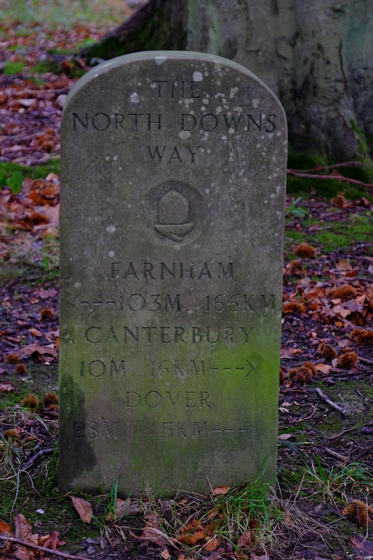
The North Downs way looked like the obvious choice. At this point I had a couple of gaps on the route at the Eastern end. One from the Battle of Britain Monument to Postling (courtesy of my first aborted attempt), and one from Dover to Canterbury. My GPX of the route showed that Dover to Canterbury was 30km, with a nice break in the middle around Shepherdswell. I threw some kit into my pack, opting at the last minute to add my Páramo Torres jacket in case it was slightly colder than planned, and headed for the station.

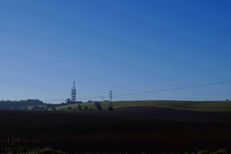
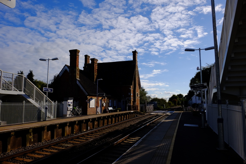
Disembarking at Dover I bimbled towards the sea front to find the official start/end point of the North Downs Way. Being a national trail, I expected there to be some sort of obvious sign on the front. I stood in the sunshine looking around for any indication of a sign. With nothing obvious showing up, I sat down on an uncomfortable seat and googled the start of the North Downs way. I had hoped to find coordinates or a grid reference. Ah, such naivety. Eventually I found a picture that suggested that the start finish post is actually a line on the ground. With this info I soon found the start of the trail. I was glad I hadn’t just walked here from Farnham to find it…

The Start/Finish of the North Downs Way (the shiny line in the middle of the picture).

For anyone else hoping to find such a point I saved a waypoint into my GPS – 51.122521°N 1.315339°E (or TR 32098 41142 in OS Grid).

Having found the trail I followed the first NDW sign through an underpass into the bustling heart of Dover’s high street. Here I promptly lost the signs again, and with not enough detail on my 1:40k map, I wandered round to Pencester Road, where I finally picked up the trail again. Here the sign was more obvious showing where I should have gone.

I followed the signs through the wide streets of Dover, the route showing a gentle incline. Here and there signs of spring poked through. Daffodils, Blackthorn blossom, Hazel catkins.

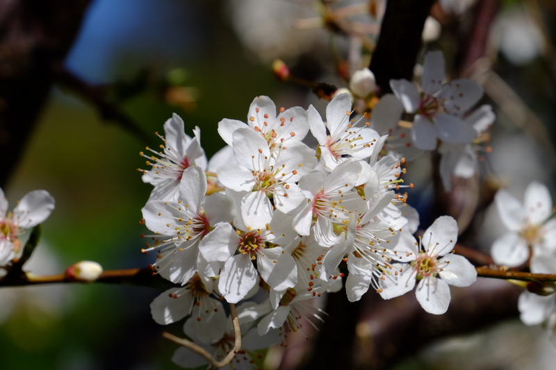
Blackthorn (Prunus spinosa) blossom at Connaught Park

I left the streets on Connaught road and followed a sunken path through a grave yard to join the old Roman Road, that climbs the hill out of the Valley and left Dover proper.

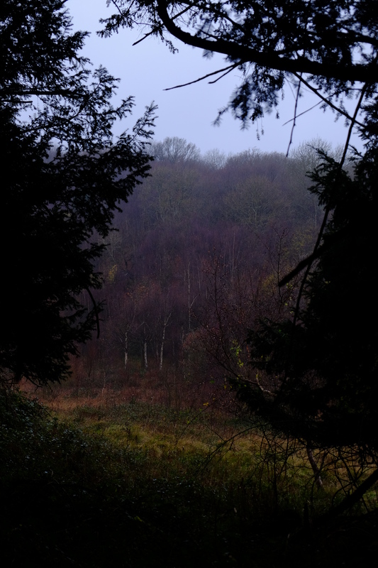
By now the sun had come out and the it was warming up into a pleasant spring day. Alas there was a slight chilly breeze so I wasn’t able to lose my windproof. The first part of the path towards the A2 has recently been resurfaced and was rather pleasant to walk along with fields on each side. Like much of the North Downs Way you can’t get far from the sound of traffic and as I headed north the sound of the A2 got louder.

On the OS map the North Downs Way is shown as crossing the A2 directly near what is now a slip road, but the Harveys Map and the sign posts show a detour to cross the A2 at a bridge.

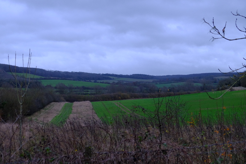
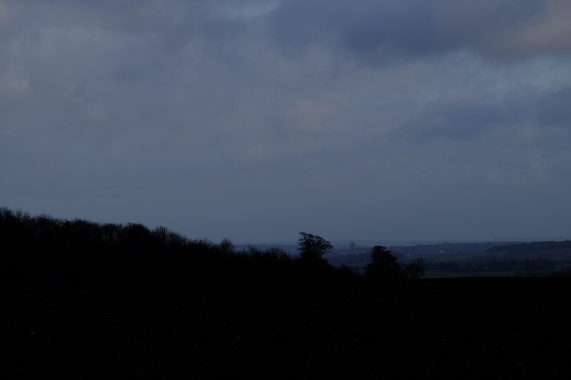
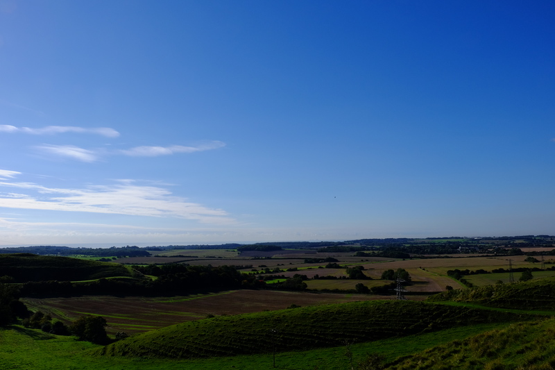
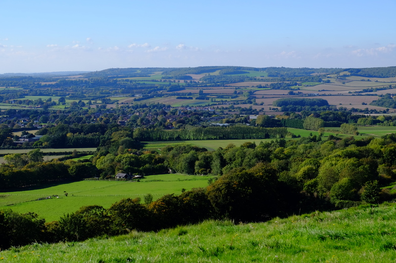
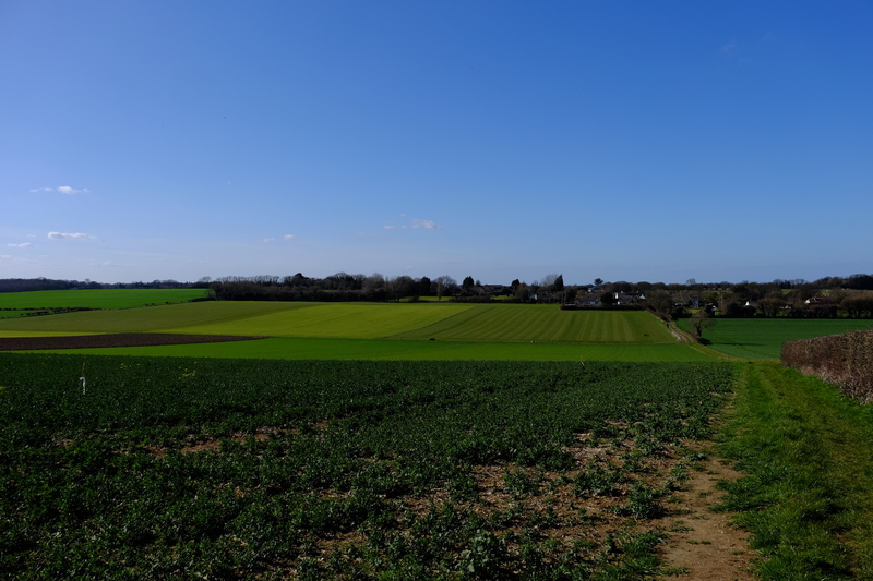
Crossing the bridge I found the green lane that the NDW follows at this point with a large concrete block in the middle of it. I didn’t think much of this, and continued on. From here, with the A2 just metres away on my left, looking north I could see all the way to Ramsgate, and the Thanet wind farm in the distance. Shame that the foreground seemed to involve someones dump…

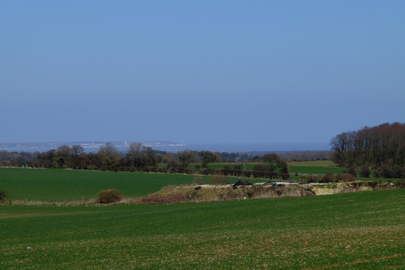
Ramsgate and the Isle of Thanet in the distance.

The path was heavily rutted, boggy in places, and made for interesting travel. At one point I had to inch along the side hanging off the branches of the hawthorn bushes to avoid the bog the path had become. When I got to the end of the rutted section I found another large concrete block and a sign. Apparently this section has been closed for 6 months so that they can fix the damaged surface. Alas the sign saying this seems to have gone missing from the other end. I took the opportunity of a seat (the concrete block) to have a snack and a drink. I then filtered some water from a nearby cattle trough before continuing on.
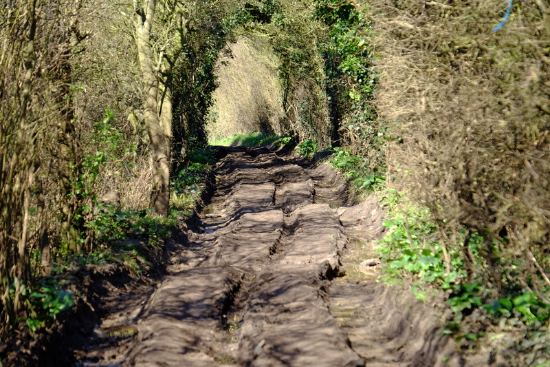
Rutted green lane

The path opened out onto open farmland, you could see from the terrain that this section used to be an trackway used for carts, but hasn’t seen such traffic in years. The fields were lush with green growth. Because of the noise of the traffic on the earlier section, I was walking along listening to podcasts on my headphones. This meant I didn’t hear when the dry bag with my loo roll in it fell off the outside of my pack where I had tied it on earlier. I only realised this as I was approaching the A256. I wasn’t prepared to backtrack to find it, so pressed on.

Many shades of green, the lush growth of spring.

In need of the loo and to refill my water bottles, I diverted just past the A256 to the Cider Works. It’s marked as a pub on the Harveys Map, but it’s actually a licensed cafe with slightly odd opening hours. I arrived just before the shut at 4pm, bought a slice of cake and an apple juice. They kindly refilled my water bottles. Restocked and rested, I once again moved on.

Rejoining the NDW, the landscape changes once again. I crossed through a church yard into pasture, through a small copse and into the lands of a country estate. I wanderd past giant mature trees, timeless pasture, and a country pile the size of which I had not expected.

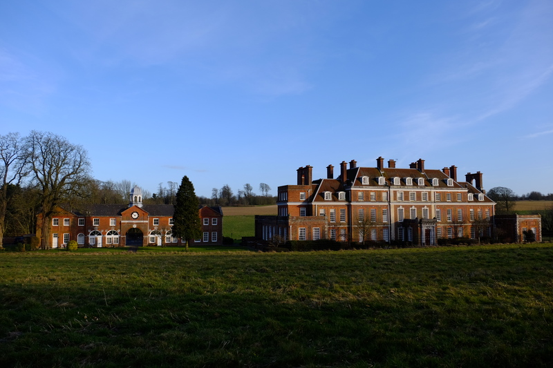
An unexpected Mansion.

Leaving the pastoral land I crossed into a wheat field that filled a whole valley. I ascended the other side into a small woodland, then back into farmland for the last couple of kilometres to Shepherdswell.

The staff at the Cider works had said that one of the pubs in Shepherswell had recently closed, but they couldn’t remember which one it was. Fortunately the one that is still open is the one nearest the NDW, and I exited the path next to the church yard and into the pub.

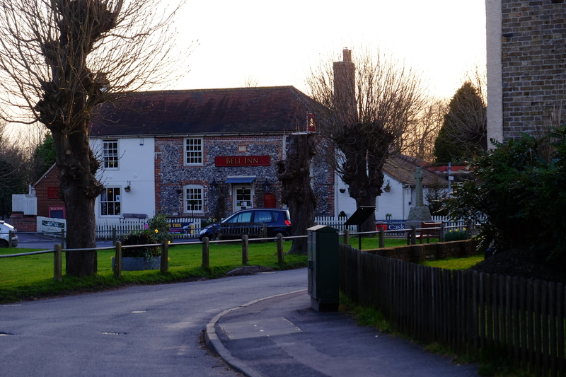
The Bell Inn, Shepherdswell – A welcome sight.

The pub had a small crowd round the main bar area, and the conversation seemed to reduce somewhat as I came in. I walked past them all with my large pack, a couple of them making comments. I collapsed onto a sofa and ordered a pint.

I knew I had only a kilometre or so until my planned bivvi location and I had a couple of hours until sunset. Not wanting to make camp until the sun was down, it seemed the logical choice was to stay in the pub until dark… It’s a hard life sometimes…

Three pints of courage and a delicious fish ‘n’ chips later, I left the pub into the star light. I wandered through the horse pastures of Shepherdswell onto where the NDW joins a country lane heading north. Away from much of the light pollution I had a clear view of the stars, and with Orion on my left, and Cassiopeia on my right, I headed north.

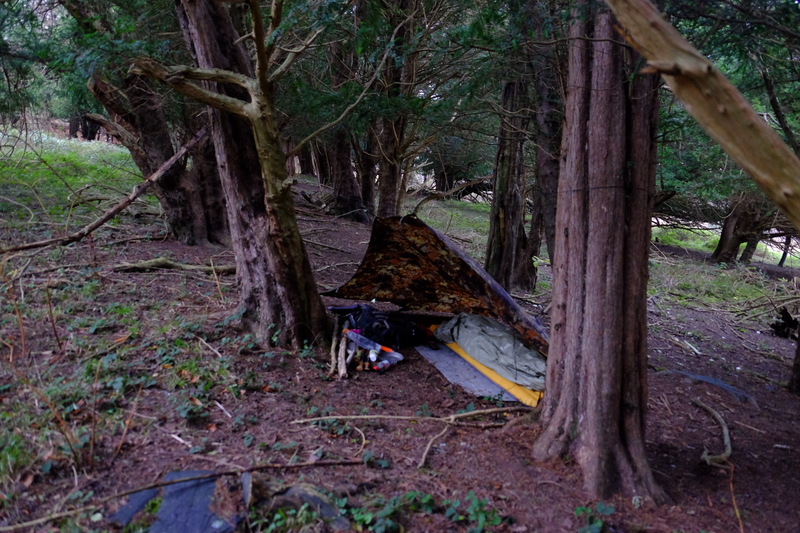
Somewhere north of Shepherdswell I left the NDW and found a spot to bivvi in an area of coppiced broadleaf trees. It wasn’t the best spot, but it was away from the trail, had some shelter from an earth bank, and it wasn’t under a Yew tree. Between the exhaustion of the hike, the 3 pints of beer and the cold, I didn’t linger long. I put up my tarp, rolled out the bivvi bag, and crawled in, still fully dressed. It was cold so I wore my Torres jacket inside the sleeping bag.

I lay there listening to the local wildlife, something rustled in the leaf litter, and in the distance an owl called. But as I lay there I realised that I was shivering. Actual body shaking shivers. This was not good. I was in a 5°C sleeping bag, inside a heat reflecting bivvi bag, with an insulating jacket inside that. I rooted about in my pack to find the space blanket that was inevitably at the bottom. I unfolded it and put it between the bivvi bag and the sleeping bag. With this in place, I curled up tight and drifted off to sleep.

I woke just after first light, I might have started the night shivering cold but I was now comfortably warm. I ventured a hand out of the warmth to check the outside of my sleeping bag. As I had feared the non breathable space blanket had lead to lots of condensation on the outside of my sleeping bag. I crawled out into the woodland and stretched, before wandering off a short way to irrigate a tree. As I returned to my camp I realised just how badly I had made camp the night before. Certainly not my finest camp…

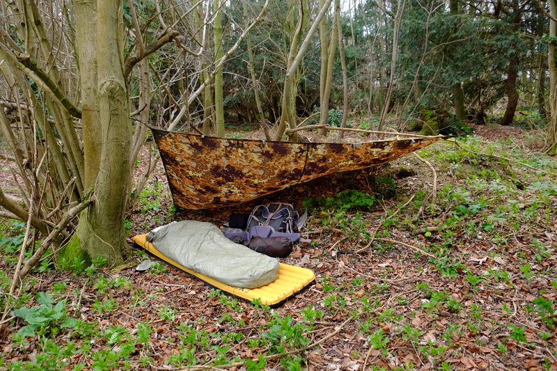
Not my best tarp pitching…

I stretched my sleeping bag out so that it could dry. The DWR coating on the bag had done it’s job and the moisture had pooled on the outside of the bag. It dried quite quickly, and just 45 minutes after I had crawled out of my bivvi bag, I stepped back out onto the trail.

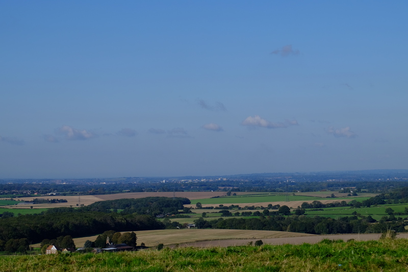
Whilst Friday had been warm with beautiful spring sunshine, Saturday was an altogether chillier and greyer affair.

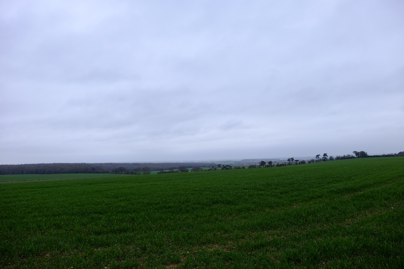
Grey skies looking towards Thanet.

From here onwards the NDW passes along side large open fields. The hedgerows of the previous day were gone, and with them their shelter from the wind. Where the path came close to a road edge, some scrote had fly tipped their rubbish.

I trudged northwards. Whilst on Friday I had covered 21.8km and didn’t feel too bad, just 5km into Saturdays hike and my feet were starting to ache. My old injury back with vengeance. I continued on, the pain increasing with every passing kilometre.

At Barham Downs I found the field the NDW passes through being ploughed by a couple of very large tractors, taking with it the obvious route through the field. I skirted along the edge where there was another path. On reaching the end of the field I had a small navigational hickup, and stopped to double check using viewranger. Position checked, I found the path a few metres beyond where I had thought it would be, and continued on.

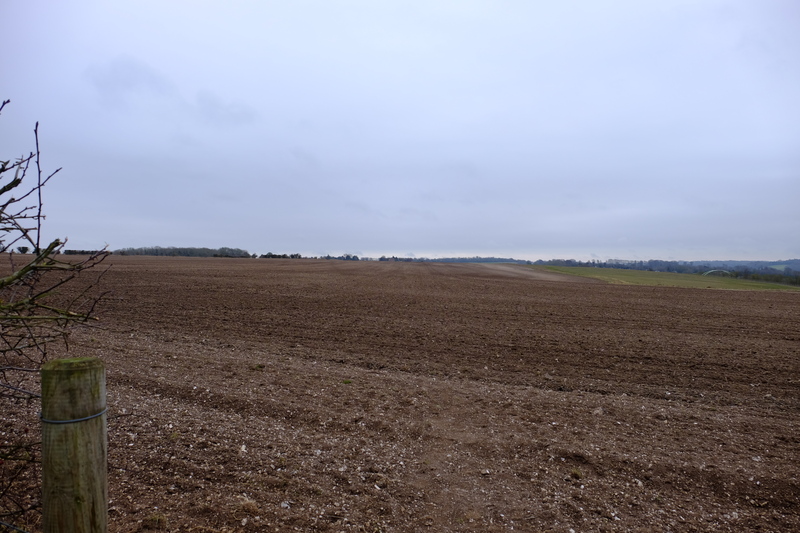
Freshly ploughed path…

Once again the NDW joins a large road, this time following along the A2 for a short section near Bridge. The pain in my feet was getting considerable, and I decided that it would be best if I diverted to Bekesbourne station and the train back to Canterbury.

Bekesbourne only has one train an hour in each direction, and not wanting to have to wait 58 minutes on a platform with no seat or shelter having watched a train depart, I pressed onwards. I passed through the pretty village of Patrixbourne, before turning off the North Downs Way into Bekesbourne.

As I hobbled along Station Approach, I heard the sound of the approaching train, and with the last drops of will power, broke into a run. The train pulled into the station when I was about 50 yards from the platform. The Guard stepped onto the platform as a handful of passengers got off. The guard saw me and I waved, calling out “please wait!”. The kind guard held the train for me blowing his whistle and closing the door behind me as I stepped onto the train. I collapsed into a seat for the short trip to Canterbury. I’d managed just over 10km today, crossing off most of the NDW between Dover and Canterbury. I’ll have to come back for the final 3.5km.

ADVENTURE: Yew must be joking, a #Microadventure in this Wind?

December the 5th. December. I looked at the weather forecast for the weekend. 12°C, It seemed to be a mistake. I checked with another source. The Brits and the Norwegians both agreed. I closed the met office app, and stuffed my summer sleeping bag into my pack along with my usual bivvi gear. I pondered what to do. I wanted a trip out, to be among the trees once more. I’d been craving the forest for weeks. Several times I’d almost gone out, but bottled at the last minute. No this time I must go. But where.

My favourite stomping ground for this sort of trip tends to mean a start from either Wye or Chilham station. From here there are various bits of woodland and downland suitable for a microadventure. I looked at the map again. Back in November I had set out on a 3 day trip involving a 23km loop starting at Wye, and going via Chilham and the Kings wood. I’d done the southern half, but aborted at Chilham after the first night. This seemed like a good opportunity to complete the loop. A simple 12km walk from Chilham station up through the Kings wood to Wye station, bivvying down in a quiet stand of trees somewhere along the way.

Bag packed I left the house with the intention of grabbing some food en route to take with me. An indication of how frazzled my brain was, I hadn’t even got out the end of the road when I’d had to return to the flat twice to collect things I’d forgotten, nothing major, just my sleep mat…

Eight minutes on a train left me standing at Chilham station in a dull grey overcast nothingness. No leaves on the trees, no sun in the sky, not even rain in the air. Just wind. Oh what a wind. The met office had reckoned on 40kph winds with gusts upto 71kph. A bit blustery,

I left the station and headed towards the village of Chilham proper. The wind bit, blowing my hair around, thrashing it against my face. Hat, why hadn’t I brought a hat? Oh yes, 12°C. I put my hood up, hoping to contain my hair, and protect my ears from the windchill. As I walked through the village I now started to overheat. Even with both pit zips wide open it was too warm. I admitted defeat and put the hood down. As long as I kept my orientation into the wind it should be mostly ok.

Walkers in Road sign.

Warning to motorists that I was here…

I turned onto the interestingly named Mountain Road. I expected this to be named for a reason, steeply inclined. But no, it was pretty much flat, maybe a gentle undulation. I got 10 yards along the road when the phone rang. This was a surprise, I hadn’t expected to have phone signal here, it’s one of the reasons I got my inReach satellite communicator. It was my dad, who seemed to think I was nuts to be out for a walk in this wind. We chatted as I walked along Mountain Road towards the Kings wood. As I walked I explained how he could login to the delorme website and track where I was, followed by experimenting with the novelty of sending messages to me via a multi billion dollar satellite network…

View across the Stour Valley. A month ago we camped in those woods.

As I reached the edge of the Kings wood, we finished the call. It was close to dusk now, and I had what I thought was another 1-2km to go before my intended camp site. I put my head down and plodded up the hill.

I’d left the tarmac’d road behind and this part of the path was a wide trackway. Rutted down the centre where the water had eroded the chalk surface. A month ago in the wet, both myself and the friend I’d been walking with had had traction issues on such exposed chalk. In the rain the chalk is like polished ice and it’s easy to fall over. Thankfully today the chalk was dry, even so I plodded up the hill carefully.

I’d brought with me a new toy, a wood burning stove. So as I wandered I kept an eye out for wood to burn. I had my usual fire kit with me, but beyond few basic tinder tabs (more on that in future post), I didn’t have anything else suitable for making fire. I would have to put my Bushcraft skills to use if I was going to have a fire tonight. As I walked I looked for some fallen birch, the bark of which makes great tinder. It didn’t take me long to spot a dead fallen Silver Birch (Betula pendula). I cut off a 18″ long length, then tried to work out how best to carry it. Taking my pack off would be a faff and I already had a walking pole in each hand. I settled on holding it under the waist belt of my pack. A few yards further on, I added a second piece of Birch to the belt. This should hopefully be enough to get me sorted. I continued up the hill.

I had brought a map with me, intending to rely on it alone, without resorting to my phone or GPS. I need to improve my navigation skills. But with dark almost complete, I chose discretion as the better part of valour, and pulled out Viewranger on my phone. As I homed in on my intended campsite for the night, I grabbed a couple more bits of dead standing to fuel the fire. Fifty meters short of the camp, I turned right off the path towards a stand of Yew trees. In the dark I discovered that what looked to be a direct walk to the Yews, was interrupted by a three meter wide ditch. The sides where steep. It must have taken me 5 minutes to slowly easy my way down the side of the ditch. Using my poles almost like ice axes. Fortunately the other side of the ditch was easier to climb up. A few more meters and I was there. Camp.

I’d spotted this stand of Yew trees on a walk earlier in the year, and thought they would be a nice spot to bivvi. What I hadn’t quite taken into account was how not flat they were. I put my pack down with my little pile of fire wood, and sat down. Breathe. I needed to find a flat spot big enough to roll out my bivvi bag without any dead branches above it that could fall in the night. I scouted around looking for a perfect spot. I couldn’t spot anything ideal in the near darkness, and I didn’t want to shine my torches main beam around too much. I try not to draw too much attention to myself when in the woods, and was using the red beam on my headlight. I found something that looked pretty flat in the dim light, it didn’t have any over hanging dead branches. It would do. I moved my pack up here along with my firewood bundle.

Before I make camp a habit of mine is to just sit and listen to the woods, get used to the area I’m in. I listened. The woods were a cacophony of noise. Branches banged, trunks squeaked, and it all set on a base line of white noise from the wind. A gust of wind shook the trees, and I felt a footstep. Adrenaline shot through my body. I was on high alert. I turned off my torch and listened. I couldn’t hear anybody to connect with the footstep. Another gust of wind, another footstep. I looked around. Sheer terror the only way to describe it. I didn’t feel alone, something didn’t feel right. I reached out to touch the nearest tree, and on the next gust, I felt the tree trembled, the vibration propagating through the soil. There was noone here, the wind was making the ground shake. Breathe.

As soon as I had my heart rate under control I decided to pitch my tarp, this would give me some shelter from the wind, some visual shelter from anyone mad enough to be walking the woods in these conditions, and would give me some sense of security. Here is where I discovered the slight downside of my chosen pitch. The trees didn’t lend themselves to a proper pitch. I thought about the options, I played them through in my mind, before deciding on pitching my tarp with the ridge along the short axis, in an open sided lean to. There wouldn’t be much room, the gap  between the trees on this axis was barely more than the width of the tarp, but if would do.

I ended up with a ridge line in a triangular config round three trees with the tarp in a sort of open sided lean to arrangement. It wasn’t perfect, but it would do to get me going. I sat under the tarp slightly out of the wind and thought what to do next. Fire.

I took the various bits of dead standing and birch bark I’d collected, and with my little folding saw processed it down until I had a pile of sticks varying in thickness from a couple of millimetres, upto thumb size. I filled the stove with sticks of various sizes, packed in some birch bark and added a lit tinder quik tab. At first I didn’t think it had caught, I was just about to light another when the flames started to grow. Success. I spent the next half hour feeding sticks into the fire, bathing in it’s warmth and glow. Alas when I looked away for a couple of minutes to make a sandwich, it seemed to die down and I needed to start again to get it going. It worked. Twice in one night. I fed twigs into the stove and nibbled on my dinner.

The wind was showing no signs of easing up and the tarp pitched the way it was, wasn’t giving me as much protection as I had hoped. I’d need to reconfigure it. I let the fire die down, and turned my eye to the shelter. In the end I dropped it down into a half open pyramid type lean to type setup. I lay down inside the shelter. The fabric of the tarp was just inches above my face. Hardly optimal. I was exhausted, it would have to do. I rolled out my bivvi bag, inflated my sleep mat, and crawled into my sleeping bag.

Various layers of heavily distilled essence of dinosaur stood between me and the elements. Gust after gust blew through the trees, with each a crescendo of white noise filled the air. Trees groaned, branches squeaked, the ground shook. Every so often the staccato crack of a branch giving way would break through the noise. I lay in my bivvi bag, nose inches from the tarp, my locator beacon clutched to my chest, listening. I have never been more terrified on a night out in the woods. Even when visited by wild boar and strange dogs.

Just as I started to drift off towards sleep, a gust picked up the corner of my tarp and blew it loose of it’s peg. I couldn’t leave it to flap in the wind all night, I’d have to leave the psychological safety of my cocoon. I took the opportunity to re do the pitch of the tarp so that it was slightly further down the ridge line, meaning that I was no longer falling out from the lower edge. I also took the opportunity to rig up a stick to try and lift the tarp off my face a bit. I crawled back into my bivvi bag and tried to sleep.

Not the best pitch I’ve ever done, but it protected me for the night.

I slept the fitful sleep of the hounded, every so often a large gust would shake the whole tarp, waking me up. Throughout the night the wind moved around so occasionally it blew into the front of the shelter, billowing it out like a parachute, at others it blew onto the lower angle, pinning the fabric against my body.

The view from my bivvi bag.

0700 came bringing with it my alarm. It was still dark, the wind still blew. I hit snooze. A grey dawn slowly broke across the forest. I hadn’t exactly slept well, and in my groggy state I hit snooze three more times. By 0900 my bladder was telling me it was time to get up, I was just about to hit snooze one more time when I heard the first drops of rain on the tarp. Sod it, time to move.

Venturing forth from my warm sleeping bag, I stood up and stretched. Looking out through the trees, I could see drizzle being blown by the wind. Sheltered in the stand of Yew trees, I hadn’t noticed this.

Drizzle.

Drizzle

I broke camp in a matter of minutes. Using a 60L pack rather than my usual 30L meant I didn’t need the usual faff of cramming everything into small stuff sacks. It certainly sped up breaking camp. I shouldered my pack looked around to check I hadn’t left anything, then looked out of the trees into a clearing. Everything was blurry. Glasses. I swore. Loudly. My glasses were in the little zip pocket on my sleeping bag… in the bottom of my backpack, underneath everything else. I unpacked, found my glasses bent them back to the shape they should be, and repacked everything. Grrr.

Knowing of the ditch I had traversed in the dark the previous night, I took a slightly different route back to the path, this one was more direct, but steeper. As I did I found a couple of game trails, one of which had a mound covered in deer scat. I continued up the hill past mounds of white chalk. From a distance I wondered what they were, but as I got closer I realised they were the spoils from a badger set. I didn’t see any prints or scats from the badgers, but their excavations were visible throughout the rest of the day.

I rejoined the North Downs way and headed west for Wye. The path here was the best I’ve had on the North Downs Way so far, wide, and of a sort of compacted grit that made relatively easy going. In places the grit gave way to mud, and in this mud the hoof prints of deer stood out beautifully. Nearly every patch of mud I passed had clear deer sign in it.

Deer sign.

I continued on for Wye. At one point I passed a information board and stopped to read it. The board explained that this was the first point on the Pilgrims way where you can see Canterbury Cathedral. Walking in the opposite direction, I never would have thought to look for it.

Canterbury Cathedral

Canterbury Cathedral

At the edge of the Kings wood the North Downs way hangs a left and heads down hill to Boughten-Lees, where it diverges, to either Wye or Farnham (eventually). Alas the sign saying this is missing at this point. I climbed over a stile into a field expecting a path to my left. No path. I pulled the map out and studied it. I’d gone wrong. I climbed back over the stile and retraced my steps 20 yards to a junction. Yep, this is it, or at least this is where the sign should be. I headed downhill.

The wide compacted grit path of the last 4km was replaced by eroded and polished chalk as I descended towards Wye. As I went I started to think about my route. By now my feet were more sore than they should be and I started to wonder if there was a shorter route to Wye. I looked a the map, and there seemed to be a path across fields that came out near the station. Deciding once again that discretion was the way forward. I left the North Downs Way, and headed across the relatively flat farmland. Out of the protection of the woods or hedgerows, here I got the full brunt of the wind and once again pulled my hood up to keep my ears and neck warm.

Crossing the Canterbury Road, I had just 2km to go to get to Wye. Alas the fields here are the flood plane of the River Stour, and the recent rain had water logged the soil. Large areas of the path where nothing more than bog that I gingerly stepped through, thinking carefully before placing each step. Twice the mud tried to steal my shoes. When not outright bog, the path was in places a polished clay that led to slipping and sliding. Fortunately I stayed on my feet.

Eventually with sore feet and aching legs I reached Wye,. I hobbled into the Tickled Trout for a well earned Roast Dinner and a pint of Ale.

Mile stone.


ADVENTURE: Wye yes! (Section hike the North Downs Way pt 2)

Back in February I started off an attempt to section hike the North Downs Way (NDW). It didn’t go well. I managed less than 10km before the foot injury forced me to accept an offer of rescue from a friend. Since then I’ve had several more appointments with a podiatrist. The product of this was a pain of made to my feet insoles. And they worked, I could walk without the pain.

Thursday night I found myself angry and upset. I needed to get out, I needed to do something to clear my mind. As I crawled into bed an idea formed, if I got up early, I could go for a walk. I set my alarm for 0600 and curled up with a plan forming in my head.

0600 in October is still dark, yet I crawled out of bed with enthusiasm. By 0630 I had packed a minimal day pack – map (OS explorer 137), battery pack for phone, emergency blanket, satellite beacon, and water filter. If I was going to stand a chance of doing this I was going to have to travel light. 1.39kg before I added lunch. Stepping out into the inky dark, I was greeted by I crisp Kent morning. A tiny sliver of moon hung in the sky. This felt good. I nipped to a cafe for a fried breakfast, followed by supermarket to pick up lunch, then headed to the bus station for the 0825 number 17 bus to New Barn Corner.

As I watched the Elham valley slip by the window of the bus I pondered what lay ahead of me – get off bus, walk 500m toward Postling, pick up the NDW, hang a right, follow the signs 15km to Wye, get train home. Nice and simple.

The clear crisp night have given way to a beautiful sunny day. I crossed the road and wander towards the NDW, everything felt great.

Etchinghill Transmitter

Etchinghill Transmitter – The NDW passes this transmitter mast on the way from Dover.

To save weight I’d only brought one of the two maps covering the days walk, the second half. In hindsight I should have brought the other one instead, and at the first NDW sign I made my first mistake. The sign seemed to point along the road, guessing it took the road a couple of hundred meters before it crossed the hedge, I wandered down the road. The NDW actually went the other side of the hedge, along the edge of the field. I followed the road into Postling village, where I took a footpath north to at last join the North Downs Way. I stopped to shed the fleece from under my windproof, it was too warm for that, and paused to take photos every for dozen yards. I made slow progress, but didn’t care, beautiful weather, and beautiful scenery. At some point I dropped my lens cap, and retraced my step a couple of hundred metres to find it. Plodding on I passed from the access land full of cows near Postling to fields. Passing through the kissing gate I looked for a NDW sign. Nothing, there was a footpath sign pointing north, but an obviously well trodden path continuing west. I took the unsigned path, hoping I’d find some indication soon.

View from Postling Downs.

View from Postling Downs

Following the path I eventually picked up signs for the NDW, and crossed Farthing common. Dodging traffic I crossed the main road into a field, I decided it was I good time for a first drink stop, and sat admiring the view while listening to the rattle of small arms fire from the nearby MOD training range. When I first attempted the NDW back in February, something that struck me was how at no point did I get away from the sound of the A20. Yet this leg, despite paralleling the M20 for a good distance, the only time I knew it was there was when I looked hard, and got the occasional flash of sun light reflecting off a lorry.

Ashford in the distance.

Ashford in the distance.

Break over, I continued north, parallel to the road until it turned left in the corner of a field and headed west again. Here the scenery changed from rough pasture and arable fields to a rolling hills of finer pasture, betwixt the quaint villages of middle England. I descended Cob hill to the village of Stowting, where the NDW moved from footpath to country lane. The black top would last a couple of kilometres before picking up a green lane along the top of Braebourne Downs. During this length the distance between NDW signs was greater than previous, just far enough for you to start to wonder if you’ve gone past the turning. On the road I asked a local for directions, who reassured me I was on the right route and to keep going. Alas this didn’t stop me taking a turn slightly too early, and having to back track. This added almost a kilometre to my walk.

The descent of Cob hill

The descent of Cob hill

Eventually I left the black top for the green lane it was approach midday, and I was feeling hungry. The green lane was shrouded by hedgerows that grew over the path creating a living tunnel to walk down. This didn’t provide much by way of places to stop for lunch, so when I came across a small patch of grass in front of a field gate, I took the opportunity to stop. It turns out had I gone another 50 yards I’d haven found a bench to sit on. Ah well.

A field of sheep and cows.

The view from lunch.

Tree lined green lane.

Green tunnel of the NDW near Brabourne

Just as I was packing my bag from lunch a dog walker with a pair of cocker spanials appeared. I ended up walking and chatting with her for the new kilometre or so before our paths diverged and I continued along the NDW.

Leaving the green lane north of Brabourne Downs, my hitherto comfortable shoes started to play up. I stopped in another field gateway to fettle my shoes in the hope of making them more comfortable.

The insoles that the podiatrist had made for me are made of two materials, a relatively firm EVA foam, with a memory poreon coating. It was these two layers that had de-laminated, in so doing the upper poreon layer was bunching up under the heal and causing discomfort. I fettled with the insoles, donned my shoes and continued. From here on the walk turned from a pleasant hike in beautiful scenery, into a slog of ever growing discomfort. The distance I could cover between stops to fettle my insoles decreased as the journey continued.

Whilst stopping to fix my shoes, I also had the opportunity to admire the view of Kent in it’s autumnal splendour.

Wye from Wye Downs.

Wye from Wye Downs.

On top of Wye Downs I filled the pouch of my Sawyer water filter from a cattle trough. This was the first source of water on the walk I had come across, other than the Tiger Inn at Stowting.

Autumn colours.

View from Wye downs, looking East.

As I started the descent from Wye Downs towards Wye, the walk become more of a hobble. Subconsciously in order to reduce the discomfort in my feet I adapted my gait, this compensation would later lead to sore muscles, as those not normally used in walking were called upon.

Once again the NDW changed, from the open land of the Downs it passed along the edge of fields freshly sewn with oil seed rape, past the old buildings of Wye college before passing alongside allotments to the back of Wye church.

The church yard of Wye church has a number of impressive yews. I hobbled on. The streets of Wye marked the final kilometer or so to the station, and the train back to Canterbury.

I’d missed the train I had aimed to get due to hobbling, which gave me a longer wait at Wye station. As I sat there awaiting my train, I checked over the route my GPS had logged. 17.9km. With the couple of kilometres to the bus stop in Canterbury it brought my total for the day to over 20km. In the previous 2 years since my foot injury, the furthest I’d walked in any one day had been just shy of 15km. I’d managed to go 33% further. It made me wonder, if I can get a more durable set of insoles, could this be the start of being able to walk properly again?

With this in mind, I boarded the train back to Canterbury and started to consider the possibilities for my next trip.

Wye Station in the Sunshine

Wye Station in the Sunshine

Postscript

Since doing this walk, the podiatrist has ordered me a new set of insoles which should be more durable, and to avoid the map issue, I’ve treated myself to the Harveys North Downs Way map.

I took a lot more photos on this walk that I could sensibly include in this post, the better shots I have put up on my photo website.