I had the good fortune of being in Barcelona for work for a couple of weeks, and knowing that I should have a couple of days while I was there to play tourist, I decided this might be a fantastic opportunity for a bit of a Microadventure.
Knowing very little of the area around Barcelona, I sought advice from Mr Microadventure himself (Al Humphreys), who suggested I have a look at Montserrat.
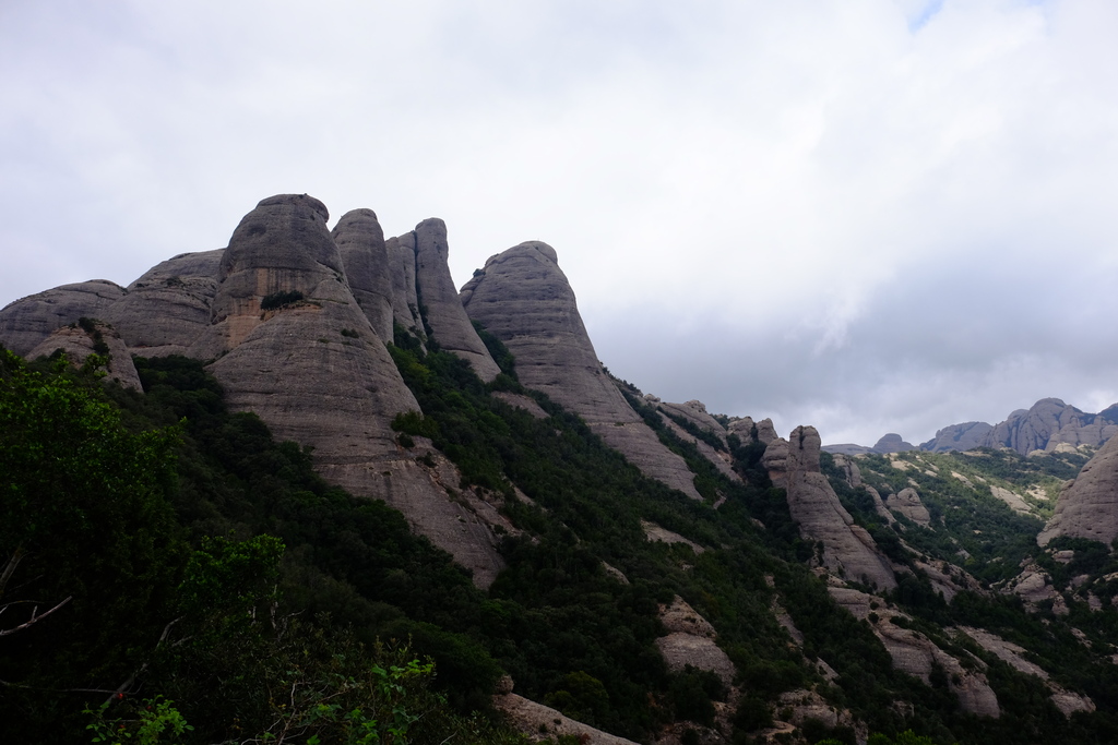
Montserrat, is a small nature park and mountain escarpment located about an hours train ride from Barcelona. It’s home to a monastery and is a popular tourist destination. While it’s approximately 10km x 5km in size, it’s terrain looked on the map at least, to offer an opportunity to get into some wilds and have a bit of an adventure.
The narrow gauge train from Espanya station trundles through the suburbs of Barcelona before entering the countryside, dotted with dormitory towns for the businesses of Barcelona, the valley was also home to numerous olive groves. I hadn’t slept too well the night before, so having got on the train at Espanya, I promptly hugged my backpack, shut my eyes and woke up 50 minutes later in the countryside.
When you buy a ticket to Montserrat in Barcelona you have a choice, you can buy a ticket including a cable car, or including a rack railway. The cable car seemed like a more interesting option of the two, and with no price difference, I opted for that.
Speaking no Spanish what so ever, and not entirely sure what the station was I had to get off at, I watched out the window hoping for some indication of where to get off.
I saw the cables of a cable car, the supporting masts. Was this the right station? I hurriedly grabbed my bag and jumped off the train just as the doors closed.
Right, which way is Montserrat… erm, oh. *DOH*. This is the wrong station. I wanted the next one. The dangle-way infrastructure is just a decoy. Bah.
I spent the 20 minute wait for the next train reconfiguring my bag. I’d borrowed a hat off a friend so that I wouldn’t combust in the Spanish sun. Alas the rim of the hat banged on the lid pocket of my rather full backpack. The floating lid of the Tempest pack proved to be a useful feature, as I fettled the straps to move the lid pocket more round to the front of the pack out the way of my hat.
Back on the train to the correct station, I tried to follow the train line as it entered the map, through tunnels, and cuttings, approaching Montserrat Aeri station. This time it was right. This time there was a big sign saying it was Montserrat, and the even bigger clue of the Monastery being visible perched precariously on the side of the mountain.
The. Mountain.
I craned my neck as I looked up at the imposing cliffs and rounded peaks. What was I letting myself in for?
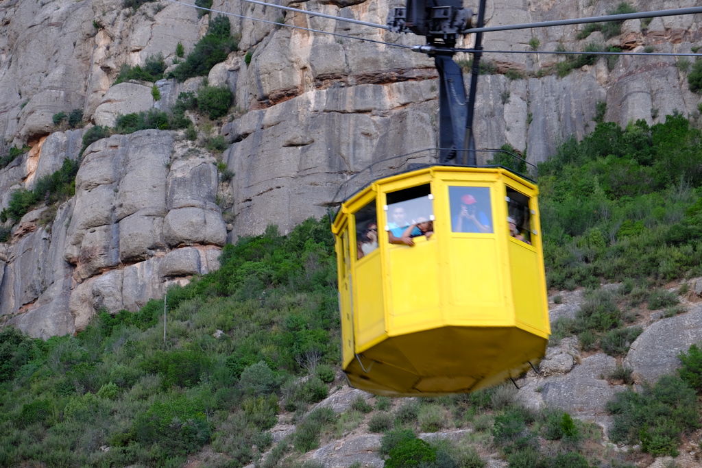
I presented my ticket to the dangle way ticket office. I must look British, as the guy responded in perfect English. “Two minutes”.
The cable car to the Monastery dates from the 1960’s. Proud photos of it’s early days adorn the walls of the station. A brightly painted gondola sat ready and waiting. The cable car attendant looked slightly bemused at my over filled pack and walking poles, with my camera hanging off my neck. A radio exchange in Spanish followed, before the gondola clanked and ground slowly out of it’s docking cradle.
Each car has a maximium capacity of 35 people. This one carried just me. Unlike many modern transport mechanisms, the gondola had proper opening windows (albeit no air-con), and I amused myself for the 6 minute journey by moving round the gondola shooting the view from various angles, trying to get a nice shot as we moved further up the mountain. Near the top we passed a packed gondola heading down. It was just past 1800, and the day tourists were starting to make their way off the mountain.
Packed Gondola On it’s way down
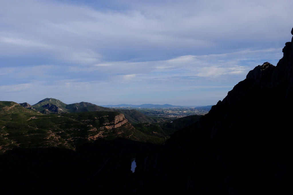
View from the cable car on the way up
The complex that is Montserrat Monastery is a substantial development. Accompanying the various ecclesiastical buildings was the various manifestations of the tourist establishment. Museum, gift shop, toilets, bar, two funicular stations, the rack railway station, and of course the station for the dangle-way. All this clings in a small space between two high peaks. The map shows a stream flowing towards the complex, but it was dry. I had planned to make some use of this infrastructure to bootstrap my hike. The Funicular St Joan, should get me 300m up to what is marked on the map as a “Strolling path”, and the start of my hike proper…
That was the theory. Alas, having used the facilities and filled my water bottles at the fountain. I wandered to the Funicular station. Locked. A sign indicated that the Funicular stopped running at 1810. I looked at the time on my phone. 1820. If only I hadn’t wasted 20 mins by getting off at the wrong stop. ARGH.
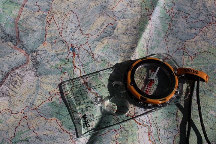
I sat down with the map. Adapt and overcome. The clearest looking route was the one up the valley from the Monastery towards the strolling path, and the greater path network of Montserrat. It’s only a couple of kilometres to the path on the map, and what, 300m of ascent. How hard can it be…
Weighed down with 3.5kg of water, on top of my packed bag, I approached the footpath. It started as a few flights of well made stairs, and while I wouldn’t say it was easy, it wasn’t too bad. I plodded up the stairs, and over a bridge, passing various day hikers coming in the opposite direction. At the end of the bridge, it looked like the path started properly and the ascent could begin.
Oh how naive. I turned off the bridge, round the tree and looked at the path.
The stair case is a rather interesting invention. Nothing in our homes causes us more injury. Falling down them, falling up them. The design of a good staircase is a triumph of ergonomics. Too big a rise (the height of each step), and you put too much strain on the legs. Too small and you don’t make sufficient gains in height. Get the going (the horizontal distance of each step) wrong and you break the stride of the user, if you’re not careful you end up with imbalanced loading, with the lifting of your weight always landing on the same leg.
What is marked on the map as a sloping path up the valley turned out to be an erratic collection of unequal randomly sized cast concrete steps. Varying in rise from 100mm to over 300mm, with goings ranging from a couple of hundred millimetres, to over a metre or so. Each carefully and lovingly crafted to be have just the right combination of appalling ergonomics that makes each step a laborious exercise. Onwards and upwards I plodded. Step by step. One foot in front of the other.
Being in a valley, the sun had disappeared beyond the mountain before I had got to the bottom step. I was rather grateful of drop in temperature. Even so, I was soon soaked in sweat.
Weighed down by 10kg of pack, various less encumbered walkers passed me. We all run our own race. I continued up, stopping occasionally to admire the view. It rapidly became apparent that my original target bivvi sites were going to be beyond my reach before night fall, and I started to consider other options. All I needed was a couple of metres of flat ground to lay my bivvi bag, Ideally somewhere with a nice view, and not too close to the path. The terrain wasn’t offering many options. At 856masl, four paths came to a junction off to the left there was a small patch of level ground. The first I’d seen since leaving the Monastery. It was over looked, and somewhat precarious, but I made a note of it as a plausible option none the less. I continued up.
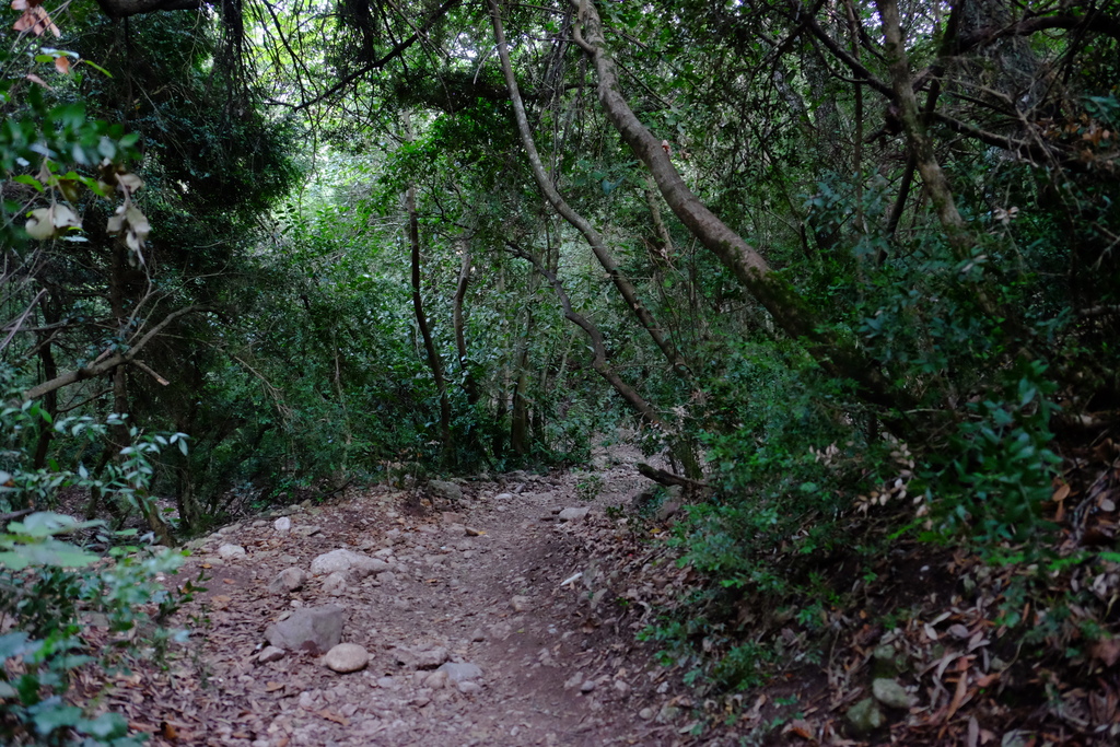
Eighty metres higher up the path, having covered very little horizontal distance, the path levelled out and I crossed the dried up stream bed again. Here the stairs ceased and were replaced by a rocky path with a sensible gentle incline.
The path followed the edge of the dried up stream bed, before reaching some switchbacks of erratically space in-ergonomic stairs. I paused at the base of the stairs, and considered my options.
The path I’d come up.
Next to the path, the stream bed levelled off into a wide flatish area filled with low trees and bushes. Some of it looked flat.
I sat on a rock and watched the path, considering my options. It was the least worst bivvi site that I’d seen since I started the hike. Sure it wasn’t perfect. But it would do. Wouldn’t it?
I watched the site for a few minutes, trying to get a feel for the area. Yes, it’ll have to do. I pushed through the bushes and under branches, looking for somewhere flat enough and big enough for a bivvi bag. The first site I found had obviously been used by a reckless hiker as a loo, they hadn’t bothered to hide the evidence. I explored further, heading up the stream bed into denser growth. I found a spot. This would do.
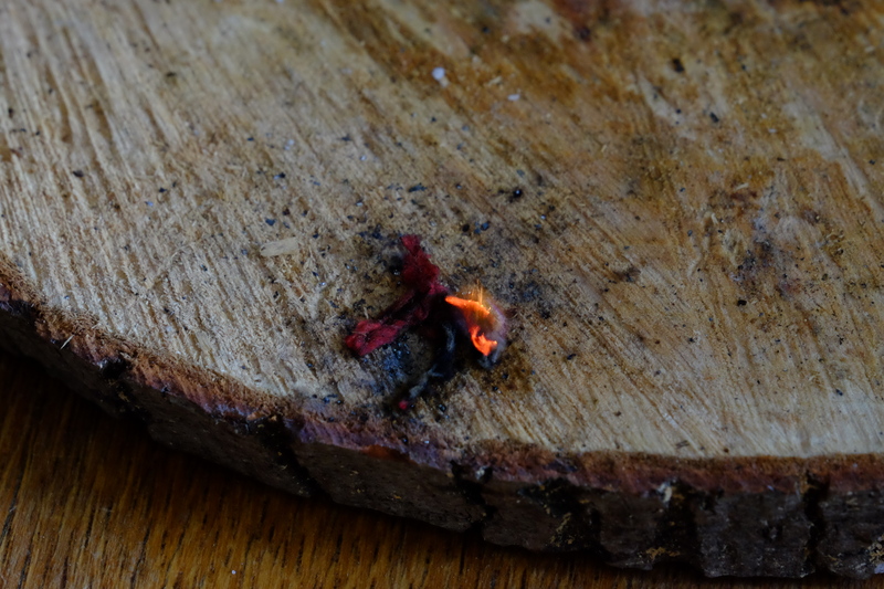
When bivviing in areas where wildcamping is perhaps not encouraged, my preferred method is to locate the site, and sit and wait till it’s fully dark before making camp properly. I watched as a few hikers plodded on up the hill. Noone seemed to notice I was there. Finally, content that it was dark enough. I started to make camp.
“Ruh ruh ruh ruh ruh ruh ruh!”
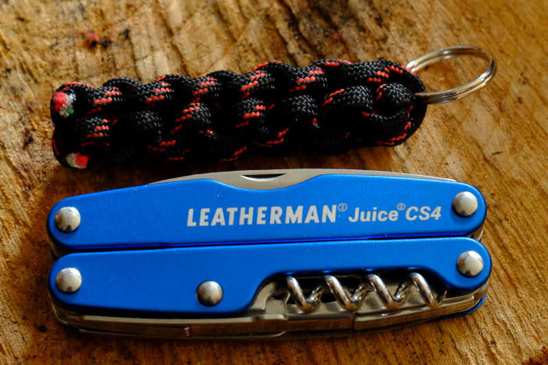
It came out of the darkness and the silence. A dog, less than a metre away, and it wasn’t happy. Neither was I. I looked around for an owner. Fifteen metres away on the path, a faint torch glowed. Was that the owner? Yes, yes it was, they were calling out for the dog to come back. I sat stock still, wondering what on earth I would do if the bark turned to bite. After what felt like days, but was probably less than 30 seconds, the dog lost interest, and headed off to find it’s owner. I sat dead still waiting for my heart to stop pounding. Breathe. Immediate threat gone, I reached for my leatherman juice, the only sharp implement I had with me. I found an empty pocket. Where was it? Damn it. I routed around in all the pockets on my pack. It wasn’t there. I took my head torch and went to search the area where I had sat earlier. Nothing. Damn. That was expensive. I returned to camp.
In the shade of the trees, in nestled in the valley, it was surprisingly cool. I was grateful of the warmth of my sleeping bag. I pulled it up round me, snuggled down. Something was digging into my side. What was it, how could something solid be in my bivvi bag. I rooted around in the darkness. My leatherman. No idea how it got there, but there it was. Phew. I put it safely in the pocket on my pack it should have been in, and lay back listening to the sounds of the forest.
I could hear a bird calling, the sounds of bats flying around above my head, somewhere in the distance, an owl called. In the peace of the forest I drifted off to sleep.
Awake. Alert. Why am I awake. What woke me. I lay still and listen. Heavy breathing. Very heavy breathing. What is it? Is that human? Is that a human male breathing heavily? Do they want to attack me? How do I defend myself. My heart raced.
*Grunt*
That wasn’t human.
*SNARF*
Yes, definitely not human. What makes a sound like that?
Boar. Wild Boar. I never knew my heart could race so fast whilst laying still. My mind went to the food in my bag. I wasn’t expecting boar in the area, so had left all my food in my pack, next to my head. Including a mature, aromatic cheese. Could the boar smell it too?
I lay as still and silent as I could. Waiting to hear what the boar would do next.
Slowly the snuffling noise faded off into the distance heading down hill. Phew. I listened to the darkness, wondering if it was coming back. Slowly, I drifted off to sleep.
*GRUNT*
Awake. The boar was back. I knew it was a boar now. My heart didn’t thunder as hard as it had. I listened as it slowly snuffled it’s way up the valley and into the distance, leaving me to return to my slumber.
*GRUNT*
It’s back again. No wait, it’s closer, and getting louder. I lay dead still in my sleeping bag. Unarmed, defenceless, and next to a smelly block of cheese. The boar snuffled closer. It couldn’t me more than a couple of metres away. What do I do. Flight? No, I’m in a bivvi bag with no zip, I’d never get out the bag. Fight? With a leatherman juice? Not an option, it’s in my pack. It snuffled closer. I moved my head to look at where it was coming from.
*SQUEEAL*
I jumped, it jumped. I stared off into the darkness as the patter of trotters heading up stream faded away. It was as scared of me as I was of it. I lay listening for it’s return.
I woke to bird song and day light. That wasn’t right, I had set an alarm for just before dawn. I rooted about for my phone and pressed the button. Nothing. Flat battery. That would explain it. My bivvi bag was toasty & warm, birds sang. I lay there enjoying the surroundings.
Alas it couldn’t last forever, eventually, with reluctance, I crawled out of my sleeping bag and embraced the morning. Well the ten minutes that were left of it…
Breaking camp was quick and simple, within 15 minutes of exiting my sleeping bag, I was stepping out onto the trail.
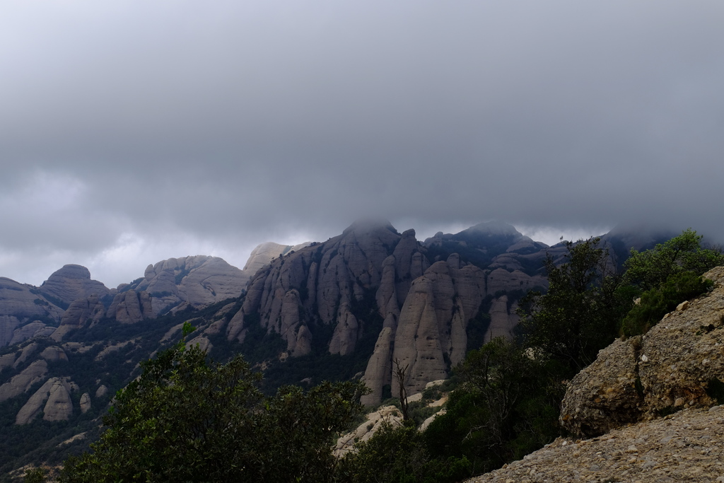
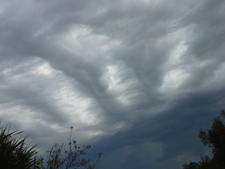
Cloud covering the tops of the mountains
The morning was grey, with low clouds covering the peaks of the mountains. At least I wouldn’t boil or need the sun cream. I approached the erratic stairs with the vigor of the new day. As I plodded up, a series of runners headed down the opposite way. Eventually I reached the strolling path I had been hoping to take the previous day. The junction contained a post with signs detailing the position (with UTM coordinate), as well as estimated times for to various points. I looked at the 50minutes it reckoned that it would take from the Monastery to this point and despaired. It had taken me over 2 hours to get to this point. Looking at the 40 min estimate to the Funicular station, I wondered how many hours it would take.
After the laborious ascent, the rugged, rocky path was a substantial relief. I deployed the walking poles, and started to eat up the distance. As I walked I pondered over why it had taken so long. Why was it so difficult. I hadn’t gone very far, yet it had taken me hours. I put the thoughts out of my mind and concentrated on the path ahead.
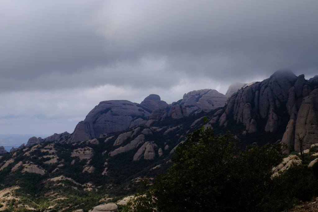
Rugged mountains of Montserrat
The strolling path was not quite what I had expected, it was mostly flat, following the contours, but had a camber that ranged all over the place, covered in loose rocks and gravel, it wasn’t what I would consider a stroll…
Pausing for a few photos, I ate up the distance, just under 60 minutes after reaching the junction, I arrived at Funicular St Joan. I’d done it. I’d done a 3rd of the distance I had intended to do, and taken 3 times the length to do it. But I’d done it. A successful Microadventure.
Rugged mountains of Montserrat
Postscript
I took the rack railway route back to Barcelona, and spent the journey trying to work out why it had been so hard. I looked at the numbers, the heights, and the distances.
From the Monastery at 718masl, I had walked up the stairs to about 950masl. 232m. That’s pitiful. I’d moved so slowly across the ground that my etrex 10 hadn’t registered any trace of me moving.
Two hundred and thirty two metres.
I needed to put that into perspective. What else is about that height?
Canary Wharf (properly one Canada square). 235m. Fifty stories. I’d climbed stairs equivalent to Canary Wharf, with a 10 kilo pack, in the Spanish heat. Perhaps I wasn’t so useless after all.
Analysing the GPS data, my trip had a height range of 324m. The 87 storey shard is 309.6m tall… The highest point of the Netherlands is 322.7m… Perhaps I wasn’t as useless as I had thought. Put in perspective, the climbing Canary Wharf or the Shard by the stairs, with a 10kg pack. Yeah, that isn’t going to be a quick hike…
Dramatic scenery, inquisitive wildlife, challenging terrain. All in all, a perfect Spanish Microadventure.
Total Distance: 4.84km
Total Ascent: 324m
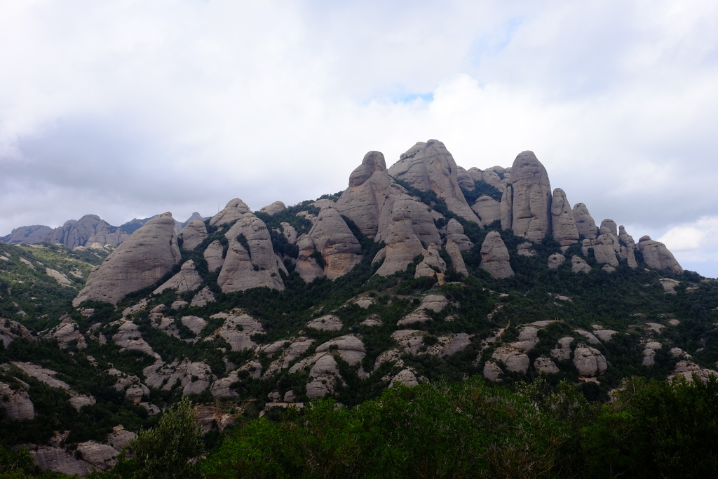
Peaks of Montserrat.